Springbrook Pinnacle

Springbrook National Park

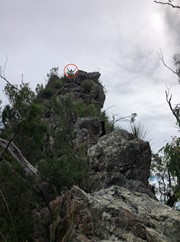
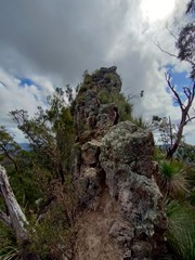
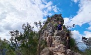
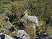
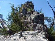
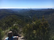
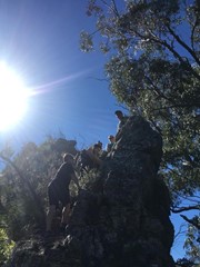
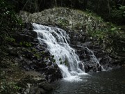
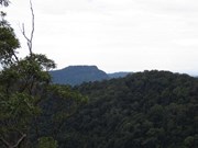
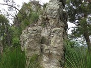
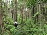
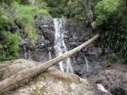
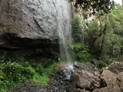
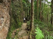
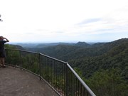
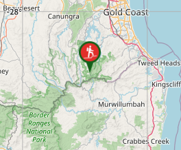
This walk takes you to the Springbrook Pinnacle via the Warrie Circuit. The Pinnacle requires scrambling but offers 360 panoramic views. The Warrie Circuit goes through rainforest with many waterfalls to see and go under.

Waterfalls
Lookouts
Scrambling or Climbing
Navigation Required
Rainforest
836m
Maximum Elevation
2954m
Total Climb

Getting there

starts at Tallanbana picnic area.start the warrie circuit and work your way down until you reach somewhere near where the track turns back around 135 degrees left around three large trees in a triangle formation from there stray off the track and go bush! Turn on your gps and punch in (lat 28* 12' 12'' S) (lon 153* 17' 46'' E)follow the ridge line and try keep as high on top of it as you can and from there continue until you reach the end where you can either go left or right, go right and then follow your gps, once you reach the base of it, take a good glance and put safety first, if you don't have a strong climbing/scrambling background it might be best not to summit the scramble, up to the summit is probally a grade 2 on the australian sport climbing scale, its recommended to even take harnesses, nuts/hexs, quickdraws, slings and a alpine rope and mabye a few free biners just to be safe and use them in a glaicer travel style manner. Return the way you came and continue the Warrie Circuit.

Maps

Which maps cover the area?

Route/Trail notes

A detailed description of the walk!

Permits/Costs

Nil

Other References

Take a Walk in South-East Queensland, p168, ISBN 9780957793170

Comments

The track to The Pinnacle is overgrown! Pink ribbons helped with navigation when I was starting to get unsure! Warrie Circuit is just beautiful l, gorgeous waterfalls!

Sonja Wentzel on 29 May, 2023

Pretty awesome lengthy walk. Waterfalls and creeks were in full force due to rain over the last few weeks. The Ridge track to the Pinnacle started at a sign for meeting of the waters and the Talanbala car park and eventually became quite overgrown at the waist level up. I could see where some other tracks had deviated from the Ridge, and there was a 10-20 min section where I couldnt see tapes, but GPS with the Australia Topo Maps app helped keep me on track. Pinnacle was relatively easy to climb without specific gear, though there were a few risky/dangerous spots to fall. Awesome 360 views at the top. The warrie circuit back to talanbala took longer than expected, partly due to 3 ankle deep Creek crossings which I deliberated at and also because of about 20+ leeches throughout the wetter tracks that I spent some time checking and burning off.
Ended up finishing the last 2 hours of the track in dark as I left after 12pm. Would recommend boots and at least 1.75L of water as I ran out towards the end. Also snapped a photo in the dark of some weird white cloud moving across the front of me which my eyes didn't catch - don't know if anyone else caught something like that? Might do the track again in reverse sometime.

Arod on 28 May, 2022

First time to the top of the Pinnacle. Great view. Lots of water after the recent rate making the walk fabulous

glenn mead on 15 Dec, 2021

First time to the top of the Pinnacle. Great view. Lots of water after the recent rate making the walk fabulous

glenn mead on 15 Dec, 2021

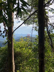
Great little hike, bit overgrown in places but easy to find your way still. Fun scramble at the end but not for the faint of heart. The views are awesome, you can see all the way to southport and back past Boyds Butte to Kingscliffe in the distance

Jesse on 12 Mar, 2021

Saw 2 snakes. Was worth it.

Clem on 17 Jan, 2021

Very scenic walk with heaps of things to see along the way! We did the whole Warrie circuit and the pinacle and it took just over 5 hours at a comfortable rate stopping to see all the attractions. The path to the pinacle from the circuit is great, certainly not a bush bash. The climb up the pinacle wasn't overly hard, if you can do Tibrogargan you can do this. There seem to be a number of ways up it but I think the easiest way is the most direct way straight up from the path (not going around the base of it). Saw a couple of snakes on the way back to the circuit, both were in a hurry to get out of our way so didn't get to identify them. Very well spent day, the views were fantastic, would be great to see all the waterfalls immediately after rain.

Vonsnrub on 20 Nov, 2020

Great fun walk, the Pinnacle is well with it.

samkramer on 19 Sep, 2020

Hiked clockwise including the pinnacle. Amazing views from the top! Some narrow scrambling spots to get there at the end but nothing too difficult. Completed in 5.5 hours with a stop for lunch and Mike with an injured knee on the way back up. Really enjoyed this one. Sarah, Mike, Danielle

Sarah on 30 Aug, 2020

Loved this track.. if you scared of heights this isn't for you..The view was amazing

Hiking Noob on 21 Jun, 2020

A great walk again and again. Tapes are in selected places only. More than enough. It's always better to navigate properly rather relying on tapes. The observant hiker can follow the ridge and mostly a track. Remember outstanding tree features and the return is even easier. The walk description has 2900+ m elevation change-certainly a mishap?

Wanderlust on 4 May, 2020

Turn off to the PInnacle just over an hour from the Tallanbana carpark (walking the Warrie circuit anticlockwise). The side track to the Pinnacle is easy to spot; first you enter an area where there a lot of big trees (it's worth doing the walk just for this), then as the main track does a sharp lefthand turn at this point I can imagine people going straight on to the Pinnacle track before they realise they've lost the main track. The Pinnacle track is quite worn for the first couple of hundred metres, then thins out, but the pink tape starts to appear from that point on.
The Pinnacle itself only appears through the vegetation when you are practically on it; it's more of a stump than spire, though there are a couple of exposed bits that would be a bad place to fall off, but technically not difficult.
Great view from the top; a bit hazy when I was there, would be great on a clear day.
Round trip including Pinnacle detour about 5h30 with stops.

John F on 3 Apr, 2020

We did the pinnacle via Mount Fairview and onto the Pinnacle. This was a good work out with some overgrown sections coming up to the Pinnacle. Loved it and the 360 degree views at the top are awesome.

Rock Wallaby on 19 Oct, 2019

Cruisey, very nice and lovely walk overall. Would recommend!

megan.devlin85 on 21 Jul, 2019

Awesome walk, the pinnacle is well worth it, but a bit of exposure, if you take it slow you’ll be fine.

Karin on 15 Jun, 2018

Lots of pink and purple ribbons currently and a very distinct footpad for the most part. Very windy and rainy today made the scramble exciting.

omb055 on 22 Apr, 2018

Some comments here read as though they are expecting a graded track. To be clear, this is NOT A GRADED TRACK, which means tree falls arent removed, overgrowth is certain and errant footpads are common.

It was an easy, fun little walk to the Pinnacle. Certainly would do again! Water was pumping after heaps of rain!

dalehikes on 22 Oct, 2017

Great little climb at the end of the track beautiful views. Track very over grown but follow the pink tape.

DanF on 13 May, 2017

This walk was nice but I didn't really enjoy it once the track left the Warrie Circuit. The pink tape was frequent and very handy but the track was quiet overgrown. There were some nice views approaching the pinnacle. We managed some scrambling but did not continue passed a rocky platform which looked ready to crumble (probably due to frequent access by hikers). Be mindful this is a whole day hike, make sure you have sufficient daylight to complete the walk. Despite all this, the views were nice and features of the Warrie Circuit are worth the journey.

rob.bushman on 19 Feb, 2017

Warrie Circuit + The Pinnacle

Agree with Anonymous' comment - there's a bit of exposure for the scramble at the end but there's no way you need protection or roping up.

Michael on 28 Aug, 2016

Where

Click here to load this map.

Nearby Walks

Done this walk?

This walk has been ticked 65 times

Aussie Bushwalking can keep track of your bushwalks.

Login/signup to tick this walk off.

Tick walks to keep track of where you've been. You must Login to tick walks. Accounts are 100% free so sign up if you don't have one.