Charlie Moreland to Mt Allan

Conondale National Park

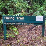
When you arrive at Charlie Moreland Camping ground in Imbil State Forest , go to visitor information then look to your left , there is a camp ground walk past that to find a gate and a sign stating Mt Allan hike trail 8.8km return
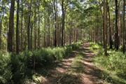
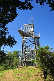
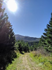
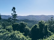
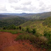
This is a steady continues incline that will lead you right up to Mt Allan firetower. This is a wide track used for fire trucks and Qld Parks to get up to the fire tower. Enjoy the amazing wide open space views of mainly a pine forest area.

Bird Watching
Picnic Facilities
BBQ
Toilets
4WD Required
No Dogs Permitted
Camping Permitted
Rainforest
Eucalypt Forest
593m
Maximum Elevation

Getting there:

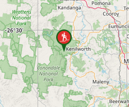
From Kenilworth travel south on the Maleny Kenilworth Road for 6km before turning right onto Sunday Creek Road. From here on, the road is unsealed, but can be used by conventional vehicle. After 5km you will reach the Day Use Area on the left, where you can park.

Maps:

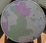
Conondale National Park Map

Route/Trail notes:

A track used by fire trucks, so open and wide but a steady incline all the way up. 

Permits/Costs:

None. There are various camping options within the park, that require you to buy a permit. See:

Conondale NP Camping

Other References/Comments:

Conondale National Park

Comments

Difficult uphill walk in the rain. Quite misty and no view from top due to trees. Saw sleeping python beside track on way up and startled a large deer on track on way down.

Anonymous on 16 Jan, 2023

A steep track through pine plantation and forest. Views are average and track is quite overgrown in places. The views aren’t overly special but there always seems to be an abundance of butterflies which is nice. Certainly not a track for hot weather.

I tried it once at about 10am in summer and barely made it a quarter of the way up in 1.5 hours time (I turned back, it was just too hot)

Another time it was earlier so made it to the top in about 2 hours ish and about 1 hour down. I am not the fittest person you’ll find, hiking is about the only exercise I get at the moment, just as a point of reference for this trail!

Acasualhiker on 6 Mar, 2021

2 hours up but i took it slow as it was a hot! Day.
Drunk 3 ltrs of water, 90% left in perspiration. Not much shade, and A lot of over growth might be worth carrying a machete. It is up hill the entire way there is no flat areas so if you are unfit probably wouldnt give this a crack until you are

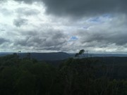
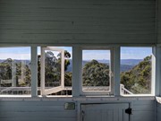
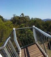
When you reach the top the tower is closed probably wont let that stop you tho. The view from the top is awesome, makes it all worth while.

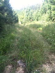
40 mins down tripped over a few times lots of loose rocks so be careful. Few patches with long grass youll have to walk through so be careful of snakes

Goodluck.

Anthony Gambino on 31 Jan, 2021

Very well marked firetrail track starting at the surprisingly popular Charlie Mooreland camping site. It begins nice and flat then quickly becomes quite steep - not ridiculously steep like the firetrails in Brisbane Forest Park, but still moderately steep. Not sure if the firetower is actually open, the sign at the start of the walk said it was closed but the door at the bottom of the firetower staircase was open, so who knows. Took me around 1hr up and 45mins down.

Vonsnrub on 16 Aug, 2020

This one is for someone with a very good level of fitness. It is uphill nearly the entire 4.4klms to the summit. Unfortunately the Fire Tower is still closed, so no view to be rewarded with when you get to the top either :(

Chris M on 30 Aug, 2019

Lovely hike up through the pine plantation, I was caught in a cloud of monarch butterflies at one point. The gradient is very steep for long legs, but the trail itself is very easy. The fire tower's 'currently closed' for repairs, but the hike can still be rewarding.

Angus Small on 30 May, 2019

Didn't think much of the vegetation through the farmed pine forests, no bird life here! Strange for a NP... The ascent was rigorous and steady but manageable for two reasonably fit over 50s. The views were great the higher we got, nice to get to just under the saddle for some almost flat walking before the final ascent to the tower. We saw some Crimson rosellas, couple of wallabies. Had the tower and the walk to ourselves bar one other on a Monday which always improves it for me!!! The tower was the highlight and the views on a showery misty days were beaut

Susan cramb on 5 Mar, 2019

3rd hike up to Mt Allan. Just love the steady 4km ascend to the Tower, then a relaxing stroll back down again.

J on 27 Oct, 2018

We set out to do this hike from Booloumba Creek but unfortunately the road was closed because of an unstable bridge (and apparently will be closed until at least October 2018). So we drove through the forest and started the hike from Charlie Moreland. Was quite steep for most of the walk and not particularly enjoyable, but the fire tower was great. Views were stunning and it was quite an interesting place. Took about an hour, 20 minutes to get up and an hour down. Hard rating due to steepness of hike.

Leith on 15 Jul, 2018

The fire tower is fun, great views. A bit tough up and down

Scott on 15 Jul, 2018

3rd bushwalk - very tough and challenging for unfit people like ourselves. Very steep uphill for 4.4km then very steep downhill on the way back. Hard on ankles and hips on way down.

Pokey and Sunshine Do Australia on 30 Jun, 2018

This was a decent hike/walk in a nice area, but I wouldn't necessarily do it again. We got to the top in an hour (4.4km), but that was at a pretty tough pace. It's a fairly steep dirt track to the top which gets your legs working on the way up, but is hard on the knees and ankles coming down. Nice view at the top and the fire tower was pretty cool. The cicadas were insanely loud (it was a hot day) and there were lots of flies, even in the Charlie Moreland campground. We saw some beautiful crimson rosellas but not much other wildlife.

kmgail on 13 Jan, 2018

A very challenging walk with very steep ascension in many areas. We had to stop often given our average fitness levels, but well worth it! Took about three hours. Lots of wildlife and a terrific view of surrounds at the top.

Cassablanca on 17 Jul, 2017

A very challenging walk but a great workout and the view is definitely worth it. This was the second time I attempted this walk. The first time a few months ago I turned back and walked along the road as the fire trail was very overgrown. After crossing 2 creeks (very little water in them at the moment) take the righthand fork and you will soon see a sign pointing you in the right direction. The first 2ks are the hardest and there are markers after this which help. Would not do this in the middle of the day in summer as the track is quite exposed.

Megs on 15 Jul, 2017

Completed did walk today and hiked up Mt allan twice as I walked down to Bolumba Creek to see the Gold Mine , so back over Mt Allan to Charlie Moreland Camp site. 18km round trip , but so worth it even just the 8.8km return from Charlie to top and back. Wide open spaces to view.

J on 31 May, 2014

Where

Click here to load this map.

Nearby Walks

Done this walk?

This walk has been ticked 41 times

Aussie Bushwalking can keep track of your bushwalks.

Login/signup to tick this walk off.

Tick walks to keep track of where you've been. You must Login to tick walks. Accounts are 100% free so sign up if you don't have one.