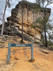
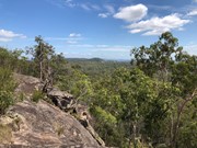
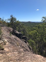
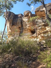
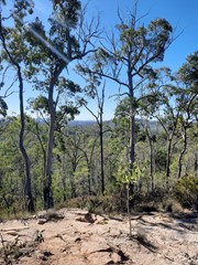
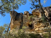
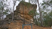
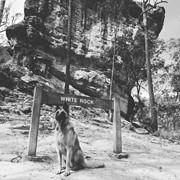
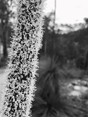
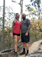
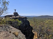
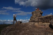
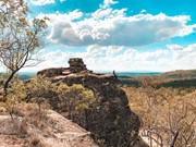
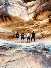
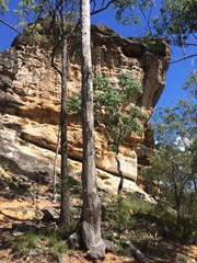
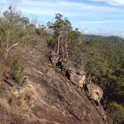
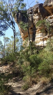
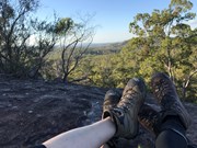
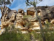
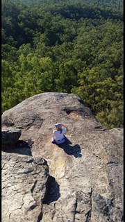
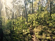
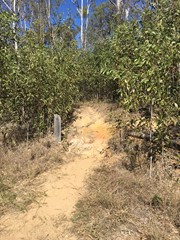
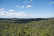
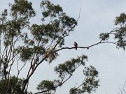
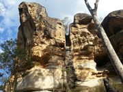
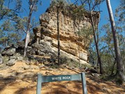
This is a moderate walk through eucalypt forest, with some rock scrambling sections, cliff-edge lookouts and limited signage. The wildlife is abundant and the scenery beautiful with large rocks and caves to explore. Take plenty of water.

Please respect the traditional custodians of the land, the Ugarapul people, and resist the temptation of climbing to the White Rock summit.

The Ridge Hike is officially listed as 'hard' due to the scrambling sections, but this walk is achievable for most adults or children with a moderate fitness level.

Lookouts
Bird Watching
Picnic Facilities
Toilets
Scrambling or Climbing
No Dogs Permitted
Eucalypt Forest
183m
Maximum Elevation
152m
Total Climb

Getting there

How do you get to the start of the walk?

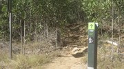
From Paperbark Flats picnic area, follow the multi user trail about 1.2km until it cuts a haul road and turns left.  Signs direct you right for the multi-use trail.  Rather than turning, follow the road east for another 50 metres, and there is a small sign marking the start of the ridge hike on the right.

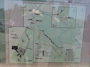
(Note that the map at the picnic area does not show the haul road, and would lead you to believe the ridge hike is directly off the multi use trail.  The map attached below gives a better idea)

Maps

Which maps cover the area?

https://www.ipswich.qld.gov.au/__data/assets/pdf_file/0011/24410/White-Rock-Spring-Mountain-Conservation-Park-Guide.pdf 

http://www.ipswich.qld.gov.au/documents/health/white_rock_spring_mountain_trails_guide.pdf

Route/Trail notes

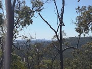
The track is obvious, but narrow and rough, and not well signed.  There are no trail markers after the first couple of hundred metres, which involves a moderate climb up onto the ridge.  Depending on the state of vegetation, there are views to the north all the way to Brisbane.  On reaching a rocky outcrop, White Rock can be seen across a col, but the track appears to peter out.  Casting around to the south reveals the last trail marker, directing you down a cleft leading down to the col.  The descent is relatively straightforward, but requires caution descending the cleft.  A few hundred metres easy walking to White Rock, where there are benches to rest and enjoy the peace and quiet.

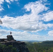
The rock can be climbed with a little effort and no specialised equipment, via another (unsigned cleft) just to the east of the north face.  There are panoramic views in all directions from the summit (about 30 metres above the rest area)

Permits/Costs

Do you need any permits? What's the cost?

Access is free.  Hiking does not require a permit.  Gates open 6am to 6pm

Other References

How can I find more info? Any guide books?

Comments

Enjoyable walk with some great views of Brisbane. Tricky to find the entrance to the walk but once found very enjoyable.

TonyS on 21 Aug, 2016

Ipswich City Council have moved their maps:
http://www.ipswich.qld.gov.au/__data/assets/pdf_file/0011/24410/white_rock_spring_mountain_trails_guide.pdf

Mick on 19 Jul, 2016

Not difficult at all, as listed...maybe medium.
Most accurate description is below-see comments of "MDWL on 8 Apr, 2016"
Well worth the trip.

enzedk8 on 9 Jul, 2016

Nice walk, not too hard and a little bit of scrambling. Great view from the top of the rock!

Chris on 8 May, 2016

Pretty easy walk, well signed and the rock is great!

BeckNWood on May, 2016

Would always choose to walk this route other than the fire trail way, every time. Route is pretty straight-forward and is really a medium, not a hard difficulty as listed.

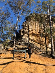
From car park, follow main fire trail/walking trail past lookouts and board walks. After about 800m trail forks. Follow it left and trail forks again after 20m, with signs to White Rock on right. Ignore signed trail and continue straight ahead for 50m. There is a smaller trail with a sign on right, leading up onto the ridge. The trail is well worn and, except during a couple of very short points, easily apparent for the whole length of the walk. Finish off by ascending White Rock itself (there is a bench and 'White Rock' sign set up under the cliff - begin ascent in the rocks to the left of the sign) or carry on along the trail for some interesting rock formations.

MDWL on 8 Apr, 2016

Really enjoyed the walk along the ridge and White Rock is pretty cool

Ian and Sue on 5 Mar, 2016

The walk is quite straightforward. I was at the top of the ridge in about 40mins from the car park and it only took 5mins to walk to White Rock. The walk from White Rock back to the car-park using the multi-use track is basically a dirt road and very easy. The view from the top of White Rock is fantastic and the rock itself is quite impressive.

Blackthorne on 17 Oct, 2015

Great little walk we did this the easy way after visiting White Rock via the multiuse trail. we headed left from the top of the timber stairs. not very well sign posted. but easy enough for us novices. Great views along the ridge. We would have struggled to have found the start of this walk if we were starting at the bottom, as no signage at the start the trail.

Jeff D on 12 Jul, 2015

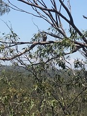
Still a few patches of wild flowers along the ridge. A pair of nesting falcons on the eastern face surprised me as much as I did them. The walk along the ridge is much more enjoyable than the multiuse trail, a little rough but not hard or terribly steep

Shorts on 16 Nov, 2014

The ridge walk is much more interesting with great views and a nice breeze, the walk that runs along the base of the ridge is flat, sandy and often dug out by bike riders.

White Rock itself is pretty cool, you can climb it or walk around the base to find the easier route up. (If you walk around the base of the rock, apparently there is a pair of nesting falcons that will swoop if you get too close, I did not see them as I climbed the rock)

I saw at least 6 people at various points along the walk, so it is a popular place to visit.

Harry van Netten on 27 Sep, 2014

This is a medium grade walk at best .. and worth doing .. particularly if you want to take your kids along. Climbing the rock is easy enough, and offers decent views from the top.

DrummerJeff on 19 Apr, 2014

We returned on this track after walking to White Rock via the Multi-user trail. The track was easy enough to follow but wasn't signed and we had to make decisions the track divided. We must have taken a wrong turn because we ended up on the Yaddunam track. Never the less I recommend the ridge. It was very green today and quite pretty.

Ian and Sue on 27 Jan, 2014

The start of this hike, a little way off the White Rock multi user trail is not signed at all, but easy to find if you look around - the multi user trail cuts a haul road, and signage directs you off to the right. Instead of turning, follow the haul road 50 metres north and there is another small sign on the right sending you up the ridge trail. Much more interesting, although more challenging than the multi user trail. Quite rugged in parts and good footwear is a must. Signage is absent a few hundred metres after the start. The track peters out on a rocky outlook where you can see White Rock ahead. A little casting around will show up the last trail marker, sending you down a cleft to go across the col and then up to White Rock.

Shorts on 21 Sep, 2013

Surprising walk

Mackamcb on Sometime...

Did the white rock ridge walk, was a great walk with great views. There was one part we found a little difficult as beginner hikers but many different tracks and photo opportunities.

Caitlin on Sometime...

Where
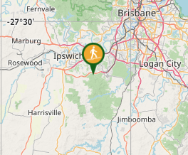
Click here to load this map.
Nearby Walks

Done this walk?

This walk has been ticked 378 times

Aussie Bushwalking can keep track of your bushwalks.

Login/signup to tick this walk off.

Tick walks to keep track of where you've been. You must Login to tick walks. Accounts are 100% free so sign up if you don't have one.