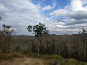
This loop starts from the Redwood Park trailhead near the bottom of the Toowoomba Range. It is a moderately challenging walk through eucalypt forest, with views towards Mount Table Top & Picnic Point. It is possible to extend your walk by following the marked side-track to the Ferny Gully Circuit (approx. 2km return). The archaeological dig site at the Eagles Nest Men's Camp historical is also located off Eagle's Nest Trail (trailhead unsigned). Caution: slippery after rain.
Officially listed as Grade 4 difficulty (includes some steep sections, loose/ slippery/boggy surfaces + limited signage), this track is suitable for walkers/runners with a moderate-high fitness level.
Getting there
From Toowoomba, drive down the Warrego Highway range crossing towards Brisbane. Look for the small dirt carpark on the left of the road, just after the 100km speed sign near the bottom of the range. Walk though the heavy wooden gate (pedestrian access only) then continue down the gravel driveway and past the picnic area to find the Grasstree Track trailhead.
Route/Trail notes
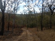
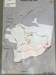
From the picnic area, walk downhill to the signed intersection and turn left onto Grasstree Track. This car-wide dirt track leads you along a few gentle slopes before curving sharply to the right and coming to another intersection (poorly signed). Take the right fork onto Eagles Nest Trail to complete the loop section anti-clockwise (the incline is more gradal in this direction). At the top of the range, turn left onto the Bridle Trail (unmarked) and left again at the last intersection (unsigned) to return via Grasstree Track.
If you want to add a short side-track, turn off Eagles Nest Trail at the yellow sign marked 'Fern Tree Gully Walk'. This walk is approx 1km return to the creek or 2.5km return if you include the extra loop on the opposite side of the creek. This hidden path is filled with surprises such as lush rainforest plants, small caves, accessible creekbed (beautiful when running) and a small waterfall. Please walk quietly here as this is a nesting place for powerful owls.
Note: Take water & a hat. Intersections at the top of the park are not signed. Be careful not to wander north onto the Bridle Trail, which would take you up to the Bridge Street trailhead via several steep climbs.
Permits/Costs
Free
Other References/Comments
GPS Tracks
- No GPS available for this walk yet.





 4
4 2
2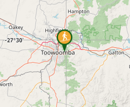
Comments