
Menu
Popular Walks
-
Mt Ngungun
(1120 ticks) -
Mount Coolum
(849 ticks) -
Mt Cordeaux
(646 ticks) -
Twin Falls Circuit
(614 ticks) -
Purling Brook Falls Circuit
(593 ticks)
Parent Regions
Sub-Regions
- Amamoor State Forest
- Bellthorpe National Park
- Brisbane City Council Local Walks
- Brisbane Forest park D'Aguilar National Park
- Brisbane Valley Rail Trail
- Coombabah Lakelands Conservation Area
- Daisy Hill Conservation Park
- Eumundi Conservation Park
- Glass House Mountains National Park
- Glen Rock Regional Park
- Gold Coast
- Ipswich
- Jimna State Forest
- Karawatha Forest
- Kondalilla National Park
- Lamington National Park
- Main Range National Park
- Mapleton National Park
- Moggill Conservation Park
- Moogerah Peaks National Park
- Moreton Island National Park
- Mt Barney National Park
- North Stradbroke Island - Minjeeribah
- Parklands Conservation Park
- Springbrook National Park
- Sunshine Coast
- Tamborine National Park
- White Rock - Spring Mountain Conservation Estate
Summary
Boarding NSW and the pacific Ocean, it is not uncommon for hikes to have views of both worlds (ocean and hinterland). Hikes here are typically on the great dividing range.
Popular Walks
-
Mt Ngungun
(1120 ticks) -
Mount Coolum
(849 ticks) -
Mt Cordeaux
(646 ticks) -
Twin Falls Circuit
(614 ticks) -
Purling Brook Falls Circuit
(593 ticks)
Parent Regions
Sub-Regions
- Amamoor State Forest
- Bellthorpe National Park
- Brisbane City Council Local Walks
- Brisbane Forest park D'Aguilar National Park
- Brisbane Valley Rail Trail
- Coombabah Lakelands Conservation Area
- Daisy Hill Conservation Park
- Eumundi Conservation Park
- Glass House Mountains National Park
- Glen Rock Regional Park
- Gold Coast
- Ipswich
- Jimna State Forest
- Karawatha Forest
- Kondalilla National Park
- Lamington National Park
- Main Range National Park
- Mapleton National Park
- Moggill Conservation Park
- Moogerah Peaks National Park
- Moreton Island National Park
- Mt Barney National Park
- North Stradbroke Island - Minjeeribah
- Parklands Conservation Park
- Springbrook National Park
- Sunshine Coast
- Tamborine National Park
- White Rock - Spring Mountain Conservation Estate
History
Any interesting history for the region?
Features
What are the standout bushwalking features?
Access
How do you get there? Include all access points if there are many?
Maps
Which maps cover the region?
Accommodation
Where can I stay there? or near there?
Camping
Council Areas:
- Scenic Rim Regional
- Gold Coast City
- Logan City
- Redland City
- Ipswich City
- Lockyer Valley Regional
- Brisbane City
- Somerset Regional
- Moreton Bay Regional
- Sunshine Coast Regional
- Noosa Shire
Contact details
See Qld National parks website
Walks in Brisbane City Council Local Walks

 900
m
return
900
m
return
 30
mins
30
mins
Crebra Circuit
A circuit for walkers only, can be joined behind the Ironbark Gully picnic area. Two bridges to traverse the mostly dry creek. Drinking water and toilets available at the picnic ground.
 770
m
15
mins
770
m
15
mins
Creek Track
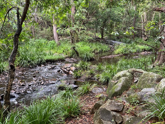
This track leads you to a creek platform that overlooks Downfall Creek. You are likely to see waterhousia and lomandra. Common crow butterflies feed on monkey vine and red ash.
Picnic area available at entrance
Grade: easy
Suited to: bushwalking
Habitat: dry riparian vine forest
Must: spend time at the creek platform listening for birds and watching the creek life
 7
km
one-way
2
hrs
7
km
one-way
2
hrs
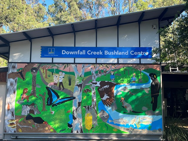
Downfall Creek Walk
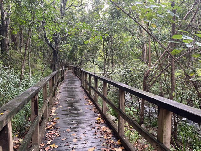
Shared path along the creek, from Downfall Creek Bushland Centre to Virginia train station. Don't miss the Huxtable Park Rainforest Boardwalk along the way.
 2
km
return
45
mins
2
km
return
45
mins
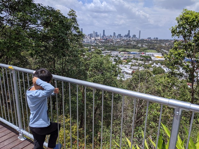
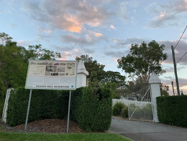
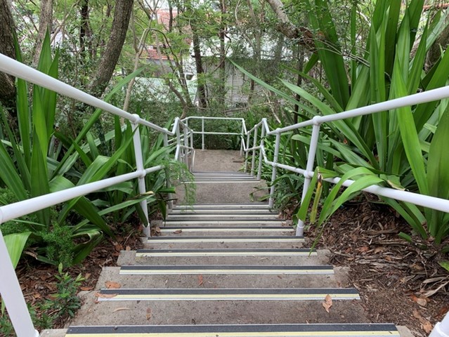
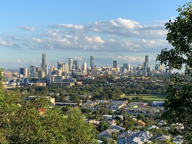
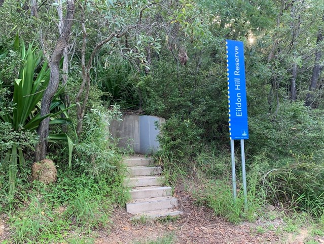
Eildon Hill Reservoir
Eildon Hill Reservoir sits at the summit of Eildon Hill, which is a strategic location for viewing the City, Moreton Bay, the Border Ranges, Cunningham's Gap, Taylor and D'Aguilar Range.
Recently a new lookout has been build as a project to improve the great places in the suburb, make them safer and connect them with the communities, family and friends. There are walking trails on the steep hill of the reservoir, which connect Windsor and Wilston suburbs. The Loop walk is upgraded as well.
https://www.weekendnotes.com/eildon-hill-reserve/192915/
 13
km
one-way
4
hrs
13
km
one-way
4
hrs
Enoggera Creek walk
Walk along the Enoggera Creek from the Enoggera Reservoir to Bowen Bridge, where the creek joins Breakfast Creek and Brisbane River. Crossing the suburbs The Gap, Ashgrove, Newmarket, Herston and many of the local parks. Mostly following the Enoggera Creek Bikeway.
 3.6
km
return
1
hr
3.6
km
return
1
hr
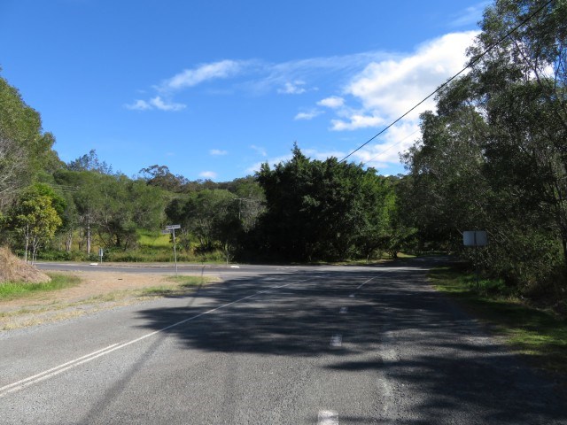
Ferny Grove Rail Trail
Brisbane's Ferny Grove Rail Trail, a 1.8km bush track which connects the Samford Valley foothills to Ferny Grove, may be short and lack romantic trimmings such as old stations and railway bridges, but of all the country's rail trails, it distinguishes itself with an infamous and tragic history.
 2
km
1
hr
2
km
1
hr
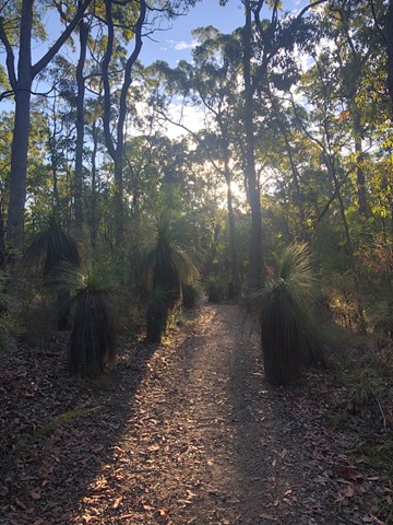
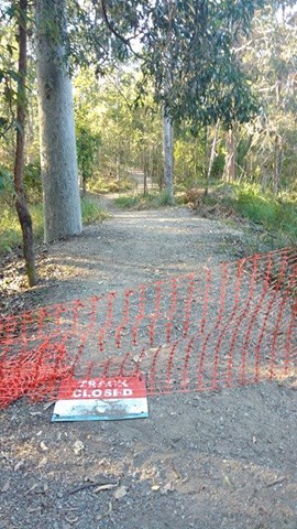
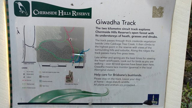
Giwadha Track
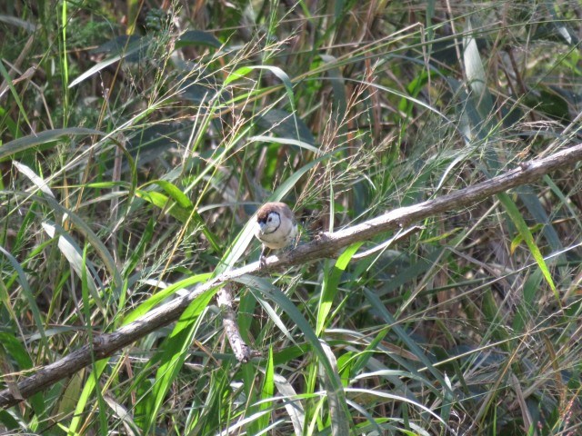
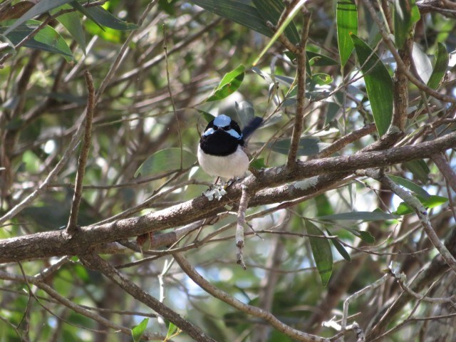
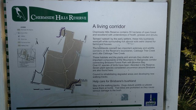
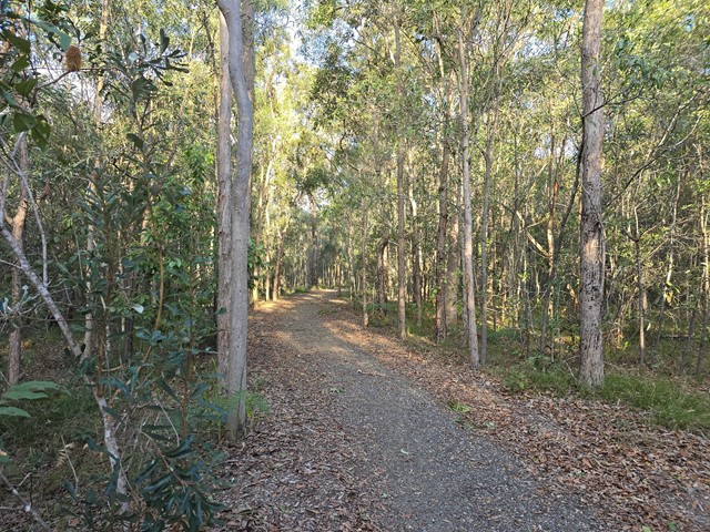
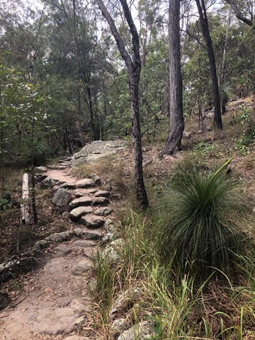
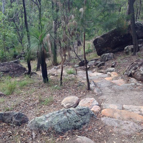
This circuit track explores the Chermside Hills Reserves' open forest with its understorey of heath, grasses and shrubs. The track passes through thick vegetation beside Little Cabbage Tree Creek and climbs to the highest point in the reserve (Spider Hill) with views of the surrounding hills and suburbs.
Grade: medium, steep hills
Suited to: bushwalking, birdwatching, flora walks
Habitat: open eucalypt forest
Must: a sunset or sunrise walk to Spider Hill for amazing views
 3.5
km
return
1
hr
3.5
km
return
1
hr
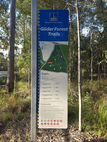
Glider Forest Trails
One of five signed recreational trails within Glider Forest allowing users to access and experience a range of different landscapes, including open eucalypt woodlands and paperbark groves surrounded by small stream-fed billabongs.
 1
km
return
10
mins
1
km
return
10
mins
Grass Tree Track
Beautiful uphill track, starting at the end of Cheval St, Tarragindi, that joins onto the Toohey Ridge Track.
 1.2
km
return
20
mins
1.2
km
return
20
mins
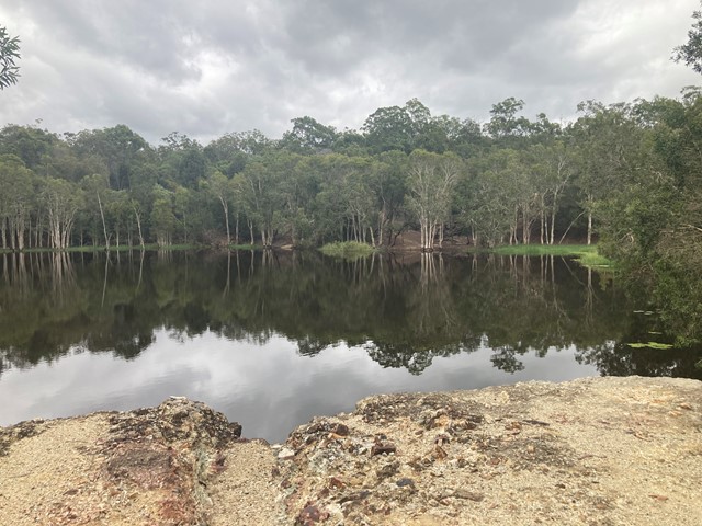
Hemmant Quarry Reserve
Hemmant Quarry Reserve is located on Fleming Road in Hemmant, 11 kilometres east of Brisbane's CBD. The 24 hectare reserve is part of the Bulimba Creek Catchment and contains open eucalypt forest and wetland species around an old quarry that is now a water body and wildlife habitat.
The reserve contains important habitat for a wide array of bird species and other wildlife including koalas.
Visitors can enjoy the reserve through a series of short walking tracks starting from the car park on Fleming Road, Hemmant.