Mt Elimbah (The Saddleback)

Glass House Mountains National Park

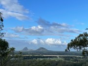
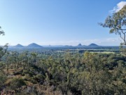
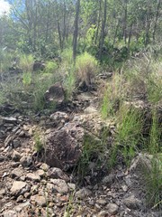
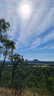
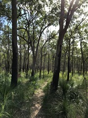
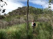
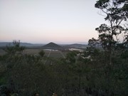
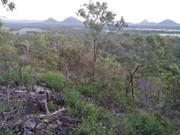
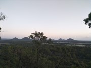
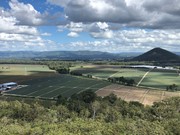
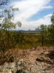
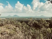
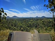
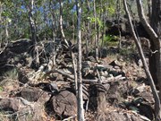
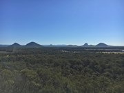
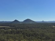
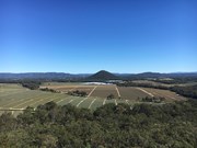
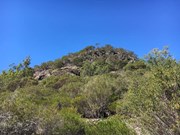
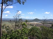
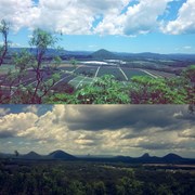
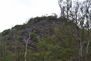
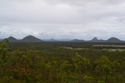
At only 120m high this is an easy climb to the top of one of the two most southerly of the Glass House Mountains. The terrain is mostly rocks with grass or dense bush but has a surprisingly good 360° view from the top.

Lookouts
Scrambling or Climbing
No Dogs Permitted
No Camping Permitted
Eucalypt Forest
120m
Maximum Elevation
70m
Total Climb

Getting there:

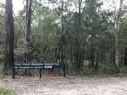
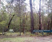
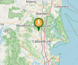
Take the Steve Irwin Way from the Bruce Highway to the Beerburrum. Take the Beerburrum Road south to Elimbah, where you turn right into Smiths Road, then right into Old Gympie Road. At approx number 799 Old Gympie Road is a small entrance to the right into the National Park car park.  National Park sign is off the road, tend to spot it as you drive past, if you get to the unsealed road you've gone too far.  Map to the car park

Maps:

None found.

Route/Trail notes:

From the car park gate the trail winds around towards the mountain for 100 metres to a fork in the track which goes either way around the mountain. However, neither of these tracks go all the way around. You then have two options:

Take the left hand track (2.8km return) and followed it for about 600m crossing two creeks/gullies. Just beyond this the track turns sharp left and it is from here you head right through the open grass area towards the mountain. There are heaps of Wallaby tracks, but no defined walking tracks, so the best way is to head straight to the summit and work out the best way as you go.

Take the right hand track (1.7km return) and after 400m you will see the 'pink flagged' (also a white arrow on a tree) entrance to the ascent. This track is now well marked and defined and takes you directly to the top.

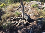
In both cases there is a requirement to negotiate the boulders and rocks and would require great care when wet.

Additional note June 2020:  I'm leaving the description of two options from respect for whoever first wrote it, maybe it was a while ago and the area has become overgrown since.  However I agree with various comments that the left hand track is of no use.  It leads firstly to a locked gate, from which a pair of wheel tracks to the right follow a barbed wire fence to end at another locked gate.  I saw no open grass areas and no view of the mountain to aim for.  Take the right hand track, it is a clear path to the top.

Permits/Costs:

None.

Other References/Comments:

Kill two birds with one stone and climb Mt Miketeebumulgrai on the same day as it is just 6km up the road.


Comments

My 10 year old grandson and i (60) hiked this track together. The area is bursting to life after recent rains and time since a bushfire had been through parts of this area at some point. We saw lots of wildflowers, birds of prey and listened to the song of the cicadas in parts.
We took the right hand path as suggested by a previous comment.
Really enjoyable

Gaynor Robin Hubble on 26 Jan, 2020

This is smallest of the Glass House Mountains, and the track is well worn - -simple to find if entering from the car park.

This is more of a hill than a mountain and is only considered a mountain to encourage more tourism to the area, but it does have nice sunset and sunrise views. Shes a nice easy walk to a rewarding spot; nice for an afternoon drink or two (just take your trash with you)

basalamant on 2020

Good easy walk,not very high but has good views of other Glass House Mountains

Bribie 61 on 3 Dec, 2019

Not bad for a little mountain. Only took 30mins return but it was a nice little hike. It's pretty burnt up there after a recent fire but the view from the top was great. Excellent vantage point for the other Glasshouse Mountains. The track wasn't really signposted but pretty easy to figure out where to go and the track is fairly well marked.

Vonsnrub on 4 Oct, 2019

Fairly easy , no people had the mountain to ourselves 1.89 km 51 min

Kmxfitness on 20 Jul, 2019

Easy yet very interesting climb, flora was better than many other mountains in the glass house area. View was pretty good.

Brad on 6 Jul, 2019

Great little hike with the option to do a climb at the very end, or follow the track around to the right and not do any climbing. The track isn't all that well defined (as some of the other mountains) so keep on eye on where you need to head back down so you can find it again.

Chris M on 2 May, 2019

Good walk with a good view

moo on 19 Jan, 2019

Little area for parking, and pink markers to show you the way, I quite liked this quick climb. Still got a sweat on but it was done in 20mins at most.
The view was better along the ridge from the actual summit.

NautiWill on 19 Jan, 2019

Hiked this and two other small Glasshouse Peaks in a morning.

Easy walk to the top of Mount Elimbah.
There’s a national park sign on the road with space for just a couple of cars.
From the carpark follow the trail and turn right and it’s easy to follow the track to the summit. Nice views of the other Glasshouse Mountains.

https://www.wikiloc.com/hiking-trails/mount-elimbah-31745440

Juiced Pixels on 30 Dec, 2018

Really worth doing, good shoes a must. Did it with the Mrs today, neither of us have ever done any climbing before so it was challenging and rewarding but also a bit scary. Didn't take enough water, only had 1L between us, would have taken more and left it at the base if we were to do it again.

AlexYo on 30 Dec, 2018

We had a couple of small confusions finding our way on this one so I thought I'd share our experiences. Using Google to navigate to the Mt Elimbah carpark took us straight there, even though the sign at the carpark mentions Saddleback. The carpark is tiny and is only big enough for a couple of cars. From the carpark we passed through the gate and after 100m came to a fork in the path. Initially we went left, but that didn't seem to be taking us anywhere, so we went back and tried the right fork, which led us straight to Mt Elimbah. It was a pleasant walk through the trees and then an easy climb once the mountain appeared. The trail was easy to follow all the way to the top and the views were very nice. It was very quiet too - we didn't see anyone else for the entire walk.

Mark on 14 Jul, 2018

I started off doing the track to the left and went as far as a fence. When I realized I went too far, I turned back to the second gully and bush bashed directly for the summit. Hindsight, I would have taken the fork to the right at the beginning, for the path you take on the left isn't a path at all. However, the top boasted quaint views of the other Glass House Mountains and farmland below. Follow the pink markers and it will be an easy walk in the woods.

Wanderingfox77 on 17 Jun, 2018

After missing the left turn at the fork and tracking back the walk was well marked. Walked the Mountain in less than an hour (up and down). Easy walk up, down is a bit more challenging with loose rocks. Due to the rain last night the rocks were slippery as well but made it in one piece and the views were amazing.

Karien Heunis on 17 Feb, 2018

A great spring day out to tick off the last two Glass House Mountains for us to climb (Elimbah and Mike). Thought that these two would be more shaly, like the Twins, but found it to be an easy rock and boulder trail.

F.A.B. on 27 Aug, 2017

Great day for it , quite easy and a rather small one still nice for when in an easy hike mood ;-)

J on 8 Jul, 2017

Wonderful view - great short hike.

Carpark can be found: https://goo.gl/maps/hpXQjpD9vH82
You really have to forge the trail yourself. But once you start off, it's pretty obvious that you just ascend! If you're unsure, the Google Map dot is the summit.

Ian on 8 Jun, 2017

I attempted this walk but couldn't find a path, and it was getting dark. I parked near the sign and took the path to the right which led all the way to a private property, back tracked and couldn't find a path heading to mountain. I did go into the bush towards the river, and say two MASSIVE barking owls perched on an old growth tree. Honestly never seen them so big - so that was a high light. Will go back and try again.

Museum of Jus on 21 May, 2017

The road no longer goes to dirt so don't wait for that. We followed the track to the left and then till the track made a sharp left turn and headed towards the mountain. It wasn't too hard though we did climb up rocks to get straight up to the peak. We followed the ridge to the lower peak and then went down from there. Good views from the top. Definitely worth the climb.

Ian and Sue on 21 May, 2016

Great walk again

AdamK on 16 Apr, 2016

Where

Click here to load this map.

Nearby Walks

Done this walk?

This walk has been ticked 125 times

Aussie Bushwalking can keep track of your bushwalks.

Login/signup to tick this walk off.

Tick walks to keep track of where you've been. You must Login to tick walks. Accounts are 100% free so sign up if you don't have one.