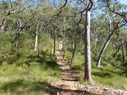
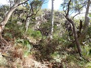
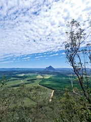
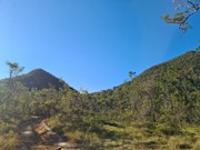
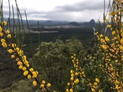
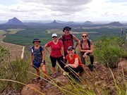
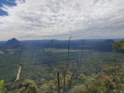
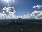
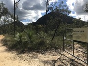
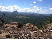
Mt. Tunbubudla is in fact two mountains known as The Twins. Not easy to access and certainly not easy to climb, but the reward is a new perspective of the remainder of the Glass House Mountains to your north.

Lookouts
Bird Watching
Scrambling or Climbing
No Dogs Permitted
No Camping Permitted
Eucalypt Forest
307m
Maximum Elevation
237m
Total Climb

Getting there:

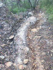
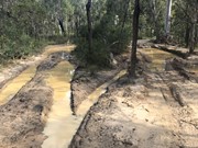
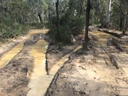
Unless you have a 4WD, then there is only one way in and then only if the weather has been dry for at least a week!  This is important to take note of.  Last time I climbed, a person was there in a honda civic - but the weather was dry.  Deep mud ruts can be seen from vehicles going there in the wet, and it is evident that a 2wd would likely become stuck in these conditions.

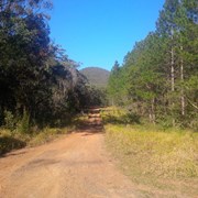
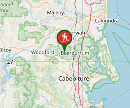
Follow the Steve Irwin Way to Beerburrum and turn west along the Beerburrum Road. After 1.8km, turn right onto Eaton Road and follow this unsealed road for 3.7km to the 'T' junction with the power lines running right and left, where you can park. The start of the walk is directly opposite you.

Maps:

The Twins

Route/Trail notes:

Follow the dirt bike track as it winds around the Eastern Twin for 1.4km till you reach a fork in the track. Take the right hand track and follow for 500m to the mountain's saddle. To the left is a well defined track that leads to the cliff face.

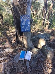
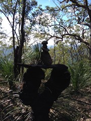
From here, you can follow the cliff face left till you find a 'pink flagged' gully leading to the top. The right hand route requires you to climb the rock face to the top. There is a rock cairn to mark the top, but the best views are from the cliff face to the north.

You now have the option to return to the 'saddle' and climb the opposite East Twin or return the way you came.

Permits/Costs:

None.

Other References/Comments:

Glass House Mountains

Comments

We only climbed this mountain today. Parts of the track are quite slippery with lots of loose rocks and steep. It makes me nervous about the east mountain but maybe some other time. The path at the bottom has some muddy parts at the moment but easy enough to navigate around. The bush at the bottom is quite picturesque. All in all this is a great walk.

Ian and Sue on 26 May, 2017

Having just climbed the Eastern Twin, this was a welcome relief; more challenging and with better views of the northern Glass House Mountains. I have looked at this range from the north south east and west and each one gives you a new spectacular view.

F.A.B. on 25 Jul, 2016

From the north gate, follow the bike trail until you reach the saddle.
From here the very obvious path up is the start, once you reach the cliff face, head left following the ribbons (or rock climb, your choice).
Not a long climb up but MUCH BETTER than East peak. Way better views and much easier and safer descent.

If you wan't to do both peaks in the one day I recommend doing East first to get it out of the way as it requires a lot more energy.
West peak is much more pleasant which leaves a better taste in your mouth at the end of the day than the crappy East peak.

dalehikes on 22 May, 2016

Was the 3rd climb of the day but the most enjoyable, the climb up the cliff face was great , thank you to those that placed the markers, very helpful on the return trip, ran out of time for the east peak but is now on my must do list

AdamK on 3 Apr, 2016

Access is though an unmarked gate on the west side of Old Gympie Road opposite the Eaton Road fork. 4WD highly recommended to get there.

Walked through gate along what is initially 4WD track, trail twisting and turning a fair bit (hard to judge accurately but probably around 2ks long). Trail has two forks in it, I took the right (heading towards mountains) both times, though I suspect it was part of a loop and you could have gone the other way? Eventually it narrows and goes uphill to the saddle. This is where you want to begin ascent - note that the access trail continues onwards and downhill along the other side of the saddle - I followed it for a few minutes out of curiosity but didn't reach the end.

Initially obvious stoney trail on left (west) of saddle leads up you up a steep slope to a rock wall. Follow rock wall round to left, where there is a narrow trail skirting round the worst of the slope, ending in a steep scramble through vegetation until you reach a ridge. Orange (and a few white) blazons (ties) mark the track from the saddle all the way to the summit, so the way was relatively easy to find, however they are missing during the steep scramble to get up onto the ridge, so note where you came up from. Intermittent trail up the rest of the way to the summit. Reasonably steep slope but still a little shorter and easier than its twin.

MDWL on 20 Mar, 2016

Early start this morning, bit hard trying to locate which 4wd track it is ( GPS confused) but eventually found it , parked car and walk further. After few days of a rain a 4wd was required. Unsure if those 4 green wooden boulders are ment to be the gate ( descriptions on here not very clear re-entrance of tracks ) but there was a small thin track leading up, hard climb, loose rocks and scrambled up , came down same way did same for the other one.

J on 30 Aug, 2014

After returning from the east summit I crossed the saddle and followed a well trodden path up the west summit. Upon reaching the cliff wall I followed the more obvious path up around the left and back onto the ridgeline. About half way up I came across some orange marker tape and followed these to the summit. Views are much better than the eastern summit even though it is not as high. Headed back down via the north side of the cliff as this was where the orange ribbon directed me. Track not as obvious and much more slippery than the ascent route. Trip from car to both summits and return done in 1hr 46 minutes with a fair amount of jogging to the base and back involved.

Grumps on 2 Dec, 2013

From Old Gympie Rd, follow the track for a few kilometres. This tracks winds around and sometimes heads away from the mountains. Eventually it arrives in the saddle between the two mountains. There is a clear track heading to the left up the mountain. The track thins out and reaches the rock face. I headed left along the bottom of the rockface until I found a way up, which was still steep and loose, but not dangerous.

Phill Driver on 16 Sep, 2012

Perhaps my favourite climb of all the Glasshouse Mountains. There is a bit of a track going left from the Saddle. The rockface you come to a few mins later is awesome. The easy way is to work yourself to the right for about 30 meteres until you find a path up. We went left and climbed up the rockface following steps / grooves in the rockface - more dangerous but also exhilerating. After that a nice ascent to the top. Great views all round.

Alan Barrie on 17 Sep, 2011

Very slippery when you get to the rockface.

jen on 16 Jul, 2011

A steep and loose climb but well worth the effort.

Laurence Hallam on 11 Aug, 2010

Where

Click here to load this map.

Nearby Walks

Done this walk?

This walk has been ticked 88 times

Aussie Bushwalking can keep track of your bushwalks.

Login/signup to tick this walk off.

Tick walks to keep track of where you've been. You must Login to tick walks. Accounts are 100% free so sign up if you don't have one.