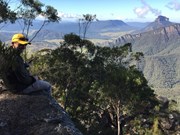
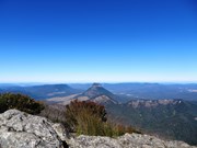
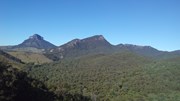
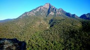
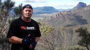
Mt Barney - East Peak - Up South-East - Down South

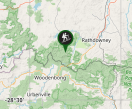
Mt Barney National Park

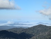
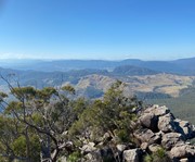
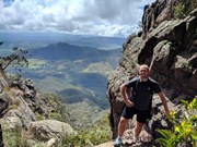
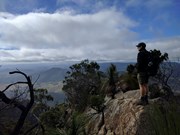
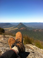
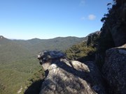
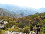
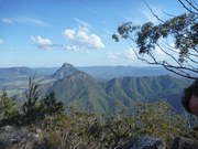
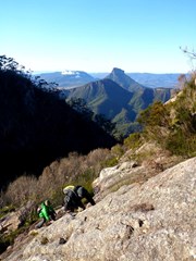
Ascent of Mt Barney via South East Ridge and descent via Peasants Ridge: a challenging but rewarding hike. The views are amazing and certainly worth the effort. If coming from Brisbane leave early and aim to be at Yellow Pinch car park by 7:30-8 am. Allow 3-4 hours for the ascent via the South East Ridge track and 2-3 hours for decent via South Ridge (Peasants Ridge) track.

Lookouts
Scrambling or Climbing
Navigation Required
Camping Permitted
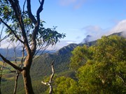
Eucalypt Forest
1351m
Maximum Elevation
1100m
Total Climb

Getting there

Access from Yellowpinch picnic area on Upper Logan Rd (enter "Yellowpinch" into GPS/Apple Maps and NOT Mount Barney!)

Maps

1:25K Mt Lindesay topographical map (Sun Map)
You can create a bespoke topographical map which can be downloaded as an image or PDF at QTopo

Route/Trail notes

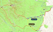
13/08/18: Updated with new South-East Ridge trailhead info (image attached showing changes)

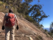
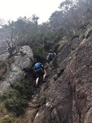
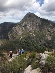
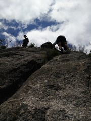
Start at the locked gate on the access road at the back of Yellowpinch carpark. Go around the gate and follow the gravel road uphill to Yellowpinch, go through the metal gate at the top and start walking downhill along the same gravel road. When you reach the bottom of the hill (approx 800m into the walk) there will be a cleared area on your right and you will see the NEW South-East Ridge trailhead; it is marked by a National Parks information board. Head along the path through the grass/shrub, cross the Logan River creek and then continue along the footpad up the steady incline. Approx. 1.5km into the walk you will reach an intersection; left going downhill and right continuing up the incline. This is where you join on to the traditional SER track. Take the right uphill, the incline will increase noticeably as the real ascent now begins. Continue along the footpath; when you come to a rock outcrop go to the right and keep heading up hill. At the next outcrop go left then right, where you should end up on a narrow ridge. Keep going up until you come to a steep deep gully go down and heading to the left climb an obvious route up. Keep going up past a razorback ridge. Where after a while you will come to a shallow gully where you head uphill to the right to a rocky slab that is a bit slippery so be careful. Keep going up hill follow the trail until another steep section and rock slab. Keep going and the summit soon comes into view. Keep going uphill with a few scrambles to the top of a rocky knoll. I found I reached here in about 3 and half hours from Yelllowpinch and followed the faint trail through scrub uphill to the summit.
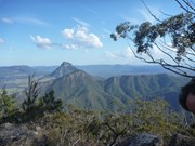
Once you finish enjoying the summit head west and downhill for about an hour aiming for the faint circle of the old Barney Hut There are obviously many different descent routes some over rock slabs some down gullies. Generally follow a south by south west bearing.  Once at the Campsite cross the creek and move uphill to Rum Jungle Campsite. The route out goes uphill with some arrows showing the way. After 10 mins or so the route descends. Keep the rocks to your left as the track steeply descends a narrow rocky ridge. When you descend to a small clearing the trail turns right then left and keep going down till you come to a steep rocky slab that can be slippery. Descend this carefully! keep following the path downhill till you reach the sign at the beginning of Peasants Ridge. Follow the road to the beginning of SE Ridge and retrace your steps back to the carpark at Yellowpinch. This walk was done when the weather was good and rock dry.

Permits/Costs 

If you camp anywhere in Mt Barney National Park, the cost is $6.15.

Other References

Take A Walk In South East Queensland. Rob Rankin Secrets of the Scenic Rim

https://hikingtheworld.blog/2018/07/08/mount-barney/

Comments

Very tough hike. This was my first time to hike the juggernaut barney. Not sure if I would do it again.

Chris Park on 20 May, 2019

Left the car park at 8am, returned at 4pm and followed the service road to the start of the south east ascent.
The walk started off really well, it’s steep and very steep in places.
Navigated across the Razorback with little effort but you do need a head for heights as to the left it drops right off.
Once past this point you come across a variety of challenges so be very aware of your footings. It can be slippy and attempting this in the rain would be treacherous so avoid if possible.
We came up to the first rock slab, not too bad but foot and finger holds are slippy even in dry weather so take care. This is also near to the edge so again nerves of steel needed. This is where the trail (loose term here) goes round to the left of the false summit, again slippy and the edges drop off. Once round you get up top and work your way to another slab. From here it’s a rock climb near edges to the top so be careful.
Got to the top for a well earned rest and then headed down the South ridge side. Not as easy as it sounded and basically just headed down and to the left. We stumbled across a tent site and found markers from there but it was vague until that point.
A longer walk back than expected and tough on the knees so take your time.
just under 18kms for the entire trek and more risky than i would have liked. Not for kids guys


Rob on 25 Apr, 2019

Very challenging but rewarding hike. I won't be doing this again any time soon but proud to say that I've ticked this one off the list! I downloaded the Wikiloc App the day before we started and I'm very glad I did because we almost certainly would have gotten lost without it.

K8 on 10 Feb, 2019

Great walk

Stoz on 10 Feb, 2019

Great summit track, new markers to help with getting up without getting lost or put off-track. 7 hours 18 minutes, we powered up and took or time getting down with 25 minutes at the top for lunch.

The creeks at the top were running rather low on this day, I never rely on water being at the top, however there has always been flowing water whenever I am up there.

Harry van Netten on 31 Dec, 2018

We started 4am at Yellow pinch car park. South east ridge up. We enjoyed some time at most of the look outs and stopped a lot, the viewe were incredible. Great looking at surrounding mountains and distant rolling hills. Strenous walk, fair bit rock scrambling, the final parts of summit were narrow and steep. Take extra care and steady hike.

Mark Aryal on 14 Nov, 2018

Beautiful Hike,
Satred hike at 5.30 am back to the car park at 2.30 pm. Long day but walk was undertaken at a slow pace.
Will return for more adventures here.

Alchemist on 11 Nov, 2018

As last commenter noted, the trailhead has been moved. It is now just at the bottom of the hill on the gravel road after passing the Yellowpinch lookout turnoff / pedestrian gate. Well signed, you won't miss it. Added a picture showing this and also updated the description.

Difficult but rewarding climb as usual. Got really lucky and had amazing weather the entire weekend so had both a gorgeous sunset and an amazing sunrise from the summit, camped down in Rum Jungle.

It has also been noted that there has been trail markers added to the SE Ridge and Peasants/South Ridge routes. IMO these are oddly placed in some cases, almost to the point that they can cause confusion. Seem to be focused on helping ascending hikers, without any markers for those descending. Just keep an eye out coming down; there are plenty of opportunities to go down semi-trodden alternate tracks which aren't as safe or easy to follow.

walkingwithtim on 12 Aug, 2018

I ascended via Logans Ridge and descended via SE Ridge and noticed a new sign for The South East Ridge with a new gate 800 metres from Yellow Pinch carpark. Is this a new track? I know they are doing work including new markers but can't find anything about this. We were in front of a couple coming down but they were at the carpark before us and assume they took this track.
This has now been confirmed, the start of the track up SE Ridge is 800 metres from Yellow Pinch carpark, through a new gate.

jgmansell on 16 Jul, 2018

Lovely hike.. Straightforward walk along the firetrail to begin with and then a bit of a climb which is what you expect from any hike, this goes on for about an hour and a half to two hours with some good views.. then starts the fun.. you have to cross over a razorback which is a bit exposed so you will have to have a good head for heights.. not difficult though. After that the proper climb/scramble starts with a lot of it being exposed you will have to hang out to roots and trees and pull yourself up. Lots of arrow markers in place so you shouldn't get lost using this route. Amazing views of the valley and Mount Earnest and Mount Lindesay all the way to the summit. The descent via peasants ridge is a lot easier the first bit involves a lot of sliding down the side of the peak but its not too steep so is ok. Lovely views of the West peak and the other smaller peaks of this amazing mountain. All up took us around 9 hours with around a half hour break on top. Great feeling once you have conquered this mountain. Good luck and have fun!!

Ashwin on 26 May, 2018

Great climb and beautiful weather

drewmac on 6 May, 2018

Very glad I had my GPS for this one. Went up via the SE Ridge which was relatively easy to follow (rangers were on the track gluing arrows to the rocks so maybe it will be even easier for future climbers). Pretty steep the whole way up with some modest scrambling. It's a bit like the push for the summit on Flinders Peak only 5 times as long. Views from the top were a bit obstructed by low clouds but fortunately when we got up there it was just clearing. Descended by the South Ridge which we thought was going to be a cake walk, I found it more tougher than the SE ascent. Lots of rock hopping, lots of opportunities to get lost, lots of falling over. Not as scenic as the SE Ridge but provides a nice view of the West Peak I wish we had time to climb. We arrived at 9:45am and got back to the car about 4:45pm with about 30 minutes at the top. Quite popular today, would have seen around 25 people on our journey.

Vonsnrub on 5 May, 2018

Nice hike - steep in parts and very long and arduous coming back. My watch counted 17.5km including getting a bit lost. I recommend the wikiLoc app to not get lost.

East peak was completely covered in cloud so no view today :/

Very hard coming down in the rain

Juiced Pixels on 25 Mar, 2018

Mt Barney via south east ridge was very challenging. It was raining and misty day. Slippery rocks made it difficult to find a good grip during rock scrambling. Planning to do it again on a clear day.

Mark Aryal on 3 Mar, 2018

Great views and scrambles up the SE Ridge. Nice clear track most of the way up, can sometimes lose the trail over the rocky parts but easy to get back on if you keep following the ridge up. Make sure to take some time to go off the track a bit and look at the amazing views of Ernest, Lindsey and Maroon.

Lia Skye
www.livingahimsa.com.au

Lia Skye on 17 Feb, 2018

Fun way to climb Barney, awesome views and lots of rocks and boulders to scramble and play on while you’re going up.

Lia Skye
www.livingahimsa.com.au

Lia Skye on 17 Feb, 2018

Hard walk with or without packs, be prepared for cramps and exhaustion and possible thoughts of giving up. But don't. The views from the top are surreal and the accomplishment is worth every step. Rum jungle is great to camp with a few flat spots, nothing will dry though as it's usually in the clouds and everything gets moist. Hardest walk I've done, but very rewarding

Simon Hutchen on 11 Jan, 2018

This is a fantastic walk. The climb is long and tiring but the route up was easy enough to follow. Following the trail on the descent of South Ridge was a bit more difficult and we had to double check the GPS a couple of times to relocate to the correct trail.

The views from SE Ridge are fantastic. Be prepared for dramatically different weather on different parts of the mountain. We had cold winds, rain and cloud at the top despite being mostly sunny at the bottom, so be sure to take a rain coat and maybe a warm layer.

Brendan on 30 Dec, 2017

Time:
Started at 0630. We took our time getting up at 5 Hours. Spent 1 hour in the saddle for lunch and exploring, then took 5 hours descending the long way. Great hike.

Water:
Although there is flowing water in the saddle, I highly recommend taking enough water to last the whole journey.. then you can empty/fill with fresh cold water if there is any available.

Snake:
We saw a healthy big brown snake (around 1.5metres) at the very top.

Harry van Netten on 12 Nov, 2017

Completed this hike with a group, managed to reach the eastern peak in 4.5 hours via south east ridge, and descended in 3.5 hours via south ridge (through the saddle and rum jungle).
Great hike, challenging and diverse terrain. The trail can be difficult to follow at times. Overall a great day, will be back many times!

Cyn on 28 Oct, 2017

Where
Click here to load this map.
Nearby Walks

Done this walk?

This walk has been ticked 170 times

Aussie Bushwalking can keep track of your bushwalks.

Login/signup to tick this walk off.

Tick walks to keep track of where you've been. You must Login to tick walks. Accounts are 100% free so sign up if you don't have one.