Mt Barney - East Peak - Up South-East - Down South

Mt Barney National Park

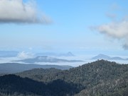
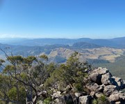
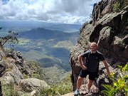
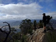
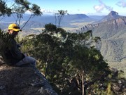
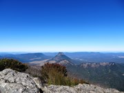
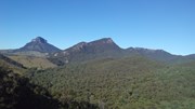
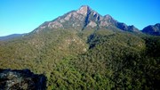
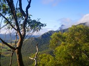
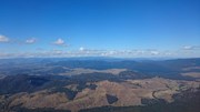
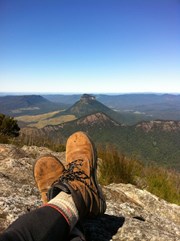
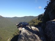
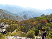
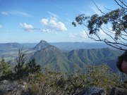
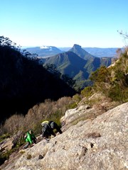
Ascent of Mt Barney via South East Ridge and descent via Peasants Ridge: a challenging but rewarding hike. The views are amazing and certainly worth the effort. If coming from Brisbane leave early and aim to be at Yellow Pinch car park by 7:30-8 am. Allow 3-4 hours for the ascent via the South East Ridge track and 2-3 hours for decent via South Ridge (Peasants Ridge) track.

Lookouts
Scrambling or Climbing
Navigation Required
Camping Permitted
Eucalypt Forest
1351m
Maximum Elevation
1100m
Total Climb

Getting there

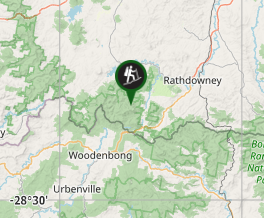
Access from Yellowpinch picnic area on Upper Logan Rd (enter "Yellowpinch" into GPS/Apple Maps and NOT Mount Barney!)

Maps

1:25K Mt Lindesay topographical map (Sun Map)
You can create a bespoke topographical map which can be downloaded as an image or PDF at QTopo

Route/Trail notes

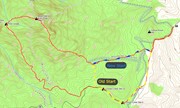
13/08/18: Updated with new South-East Ridge trailhead info (image attached showing changes)

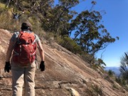
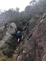
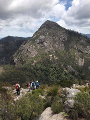
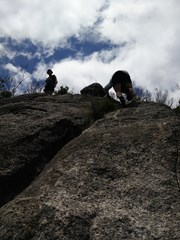
Start at the locked gate on the access road at the back of Yellowpinch carpark. Go around the gate and follow the gravel road uphill to Yellowpinch, go through the metal gate at the top and start walking downhill along the same gravel road. When you reach the bottom of the hill (approx 800m into the walk) there will be a cleared area on your right and you will see the NEW South-East Ridge trailhead; it is marked by a National Parks information board. Head along the path through the grass/shrub, cross the Logan River creek and then continue along the footpad up the steady incline. Approx. 1.5km into the walk you will reach an intersection; left going downhill and right continuing up the incline. This is where you join on to the traditional SER track. Take the right uphill, the incline will increase noticeably as the real ascent now begins. Continue along the footpath; when you come to a rock outcrop go to the right and keep heading up hill. At the next outcrop go left then right, where you should end up on a narrow ridge. Keep going up until you come to a steep deep gully go down and heading to the left climb an obvious route up. Keep going up past a razorback ridge. Where after a while you will come to a shallow gully where you head uphill to the right to a rocky slab that is a bit slippery so be careful. Keep going up hill follow the trail until another steep section and rock slab. Keep going and the summit soon comes into view. Keep going uphill with a few scrambles to the top of a rocky knoll. I found I reached here in about 3 and half hours from Yelllowpinch and followed the faint trail through scrub uphill to the summit.
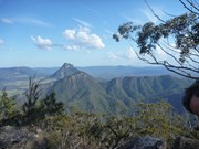
Once you finish enjoying the summit head west and downhill for about an hour aiming for the faint circle of the old Barney Hut There are obviously many different descent routes some over rock slabs some down gullies. Generally follow a south by south west bearing.  Once at the Campsite cross the creek and move uphill to Rum Jungle Campsite. The route out goes uphill with some arrows showing the way. After 10 mins or so the route descends. Keep the rocks to your left as the track steeply descends a narrow rocky ridge. When you descend to a small clearing the trail turns right then left and keep going down till you come to a steep rocky slab that can be slippery. Descend this carefully! keep following the path downhill till you reach the sign at the beginning of Peasants Ridge. Follow the road to the beginning of SE Ridge and retrace your steps back to the carpark at Yellowpinch. This walk was done when the weather was good and rock dry.

Permits/Costs 

If you camp anywhere in Mt Barney National Park, the cost is $6.15.

Other References

Take A Walk In South East Queensland. Rob Rankin Secrets of the Scenic Rim

https://hikingtheworld.blog/2018/07/08/mount-barney/

Comments

Many different ways to approach Barney. Finding the south trail was a nice quick (but very steep) way to get down the mountain after bush bashing up.

alxhoff on 14 Jan, 2016

Very enjoyable and quite challenging in parts climbing Barney SE Ridge. Route generally easy to follow with the occasional reference to the track in OpenMaps. About 3 and a half hours up and 2 and a half down. In cloud from about 1000m so no views, but that's not why you climb mountains anyway right?

mattyc on 26 Sep, 2015

Mount Barney is by far my favourite spot in SEQLD for a hike! My small group is into the really hard, some might say dangerous hikes, and Mt Barney and surrounds never ceases to fulfill our quest for adventure.

We've done this track many times, both during the day and during the night, and in every possible weather, from searing heat to nasty storms. Even for us experienced hikers this route presents enough challenges to make it a regular trip.

The biggest advice I have for anyone new to hiking or to Barney is to NOT underestimate this route. This is not a gentle walk in the park, especially in wet weather and when carrying a heavy pack for an overnight adventure. Prepare well. Bring warm clothing (even in summer it can get cold here - especially when it rains and the winds pick up), bring ample food and water, wear appropriate clothing (forget the jeans and casual shoes) and for gods sake if this is your first trip go with someone who has done the route, far too many people get lost because of their naivety and inexperience with bush navigation.

For anyone thinking of doing this route: do it! It's a beautiful hike, with plenty of flowers, birds, insects to really admire. The views are spectacular, and the other hikers you may come across are always friendly and smiling! :)

Oh and timing wise, don't rush, always go at your own pace. We love competing against our previous times however....Our best effort is about 5 and a half hours return from the carpark, with daypacks, running in and running out. With a full pack (about 15kg), have done this in just over 7 hours return from the carpark.....

Have fun and TAKE YOUR RUBBISH WITH YOU!!!!!! :)

yesitsme on 13 Jul, 2015

Mt Barney. LOVED the scrambling & views while ascending on SE and then the last bit of descending on Peasants ridge (the little Forrest amphitheater and path down to the base of the mountain - gorgeous :) Legs and arms were pretty sore for 24 hours afterwards. Everything that others said here is relevant. It is a difficult hike that requires pretty good navigational experience and endurance. Hope to do it again and maybe other ridges after that.

agms on 4 Jul, 2015

The only exception being that I ascended and descended via the SE ridge, as opposed to descending via the South ridge.

Ben on Jul, 2015

Brilliant, cloudless day.
Truly spoilt.
Track notes are spot on while concise.
Love the high sections.

drewmac on 10 May, 2015

Three of us left Yellow Pinch at 7am. It was a bit more difficult than the other two expected and they didn't quite make it two the top. I continued to the East summit and descended via Peasant's with another group, getting slightly lost between the summit and the saddle.
Very challenging yet excellent hike! The views on the way up the South-East ridge are breathtaking and just kept getting better. The variety of terrain, including rock hopping and a short climb, keeps things interesting. The descent was not too difficult but equally as enjoyable, turning into a very relaxing stroll near the bottom.
I would have to say this is one of the best hikes I have ever done, definitely planning on returning and possibly camping the night.

Macduff89 on 25 Apr, 2015

This truely is a very hard walk. Dont under estimate it. Start early. Dont go if raining. We started to late. Due to some mishaps we didnt reach the base of the mountain till 1pm. But as we were camping up top thought we would be ok. Nup! Dragging packs up with us, it stated raining 3/4 of the way up. We summited on dark (about 5.30). It was then that the rain turned into a thunderstorm. The entire mountain was a river making it impossible to follow any faint track. No sooner did we find tape in a tree then we lost it again. We finally made the decision to bivi on the mountain side in the only spot without water blasting through. Shivered soaking wet through the night on a rock. Survived the night to find we were only 100 metres from the hut site. Would we do it again. Yes!!
Start early and in the dry

Pardo on 4 Apr, 2015

I severely under estimated this climb.
Due to pretty much all other hikes that i have been on having been overestimated on the official government descriptions a friend and i thought we would be fine as long as we took enough water and food and were in pretty decent shape.
Failed badly and ended up smashing through lantana for about 3 hours. Definitely didn't help that we somehow forgot my printout of these instructions. Instead of turning left through the metal gate at the start we went straight past it then up and over a steep hill down to a creek.

Our excitement and adrenaline was far too strong for our senses at this point. After trekking around looking for a path for a few hours we just decided to try and climb up one of the ridges. Terrible idea. Managed to get a fair way up one before we realised that it was impossible without taking too much risk so decided to try and get across to the next ridge on the left which was pretty tough and then for the same reason across to the next one after that =| By that point we were up quite high and i think we still were not on the South East ridge.

My legs started to cramp up badly and a headache started building so it was definitely an amazing choice to turn back there since it was 2:15 and we didn't end up getting back to the car until just before darkness. The hike back was hell. The little cliffs and waterfalls which seemed the safest and fastest way down seemed to just keep appearing and were all dangerous and tough. The tops of the trees at the bottom seemed to be forever away for so long too.

After finally reaching the bottom we only had a very vague idea of which direction to get back and my body was already ruined. At least 2 hours of extremely hard going through think lantana and trees we finally found the creek/stream again and were very fortunate to manage to find the steep hill back to the car park again.

It was a huge relief to finally find the carpark again. Overall i probably don't realise just how fortunate we are that we only received same really scratched legs ( i did fall at one point and was very lucky not to break anything), that we madaged to find our way back, that none of my less capable friends that i know came along and i will never tackle a hike where people say (take a map and compass and learn how to navigate first!!) without doing that very thing and i urge anyone who reads this to do the same thing!!

Also i took 4 litres of water and that was not enough. Though i am a fairly big guy and sweat a lot and we actually probably travelled further then is needed to get to the summit and back on the normal route. Ended up drinking a heap of water from the stream at the end and didn't get sick either.

Sorry about the terrible writing but i am tired and have to work in the morning. After all that though it was great fun!!!! Can't wait to go again ASAP better prepared of course!!!

Jeffrey Preston on 27 Mar, 2015

8 hour walk. Care must be taken between at 950m (razorback) 1100m to 1250m. Steep drop offs and rock scrambling is required - care must be taken and only for experienced hikers/climbers. Take it slow on incline to be sure not to loose pathway that is not marked. Recommend not descending via this route due to steepness at top of mountain and many loss of trail downhill due to multiple escarpment routes.

Badger on 16 Sep, 2014

Put this off for ages, I was worried I wouldn't handle it. Was a bit of an effort fo sho, but we lucked into a perfect day and saw every possible wildflower and bee. So great, so worthwhile. Get hike-fit first

SunJunkie on Sep, 2014

Second time on Mt Barney, and just as painful as the first. Its a truly great mountain climb, with spectacular summit views.

DrummerJeff on 29 Aug, 2014

First over night hike, first hike with a 12kg pack and first hike rushing to avoid a lightning storm. Ascending the more difficult route was a great idea as by the next morning my knees were shaking every step. We did the South summit on day 1 and got a few minutes away from the West peak on day 2 however due to time constraints and the state of my knees we had brekky about 40m's from the summit. Was a brilliant view.

I do not recommend this route if rain is predicted, it was slippery and unpleasant sweating under a rain jacket. Still, a great walk I'm very proud of :)

Alice on 26 Jul, 2014

Challenging but very rewarding walk! Some very exposed sections on the ascent up South East Ridge that will get the adrenaline pumping on the relentless climb to the peak. Well worth the effort with spectacular scenery on the way up and at the peak. The descent is fairly hard on the knees and could be quite difficult in wet conditions.

Kathryn03 on 6 Jul, 2014

I had read a number of blogs etc prior to climbing Mount Barney, and any story you read re this grueling climb is true. Its a great climb, but its indeed hard work. Awesome views while climbing on South East Ridge, and just breathtaking at the top. Am going back again this coming weekend to do it again.

DrummerJeff on 7 Jun, 2014

Awesome walk on a perfect day. Departed car park at 7am made the summit via SE ridge ( some scary scrambles next to big cliffs) at 11:40, returned to car park via the south ridge at 3:45pm.

Youngy on 23 Apr, 2014

A long day walk with unmarked tracks but the view was worth it :)

Ruby on 18 Aug, 2013

Camped up in Rum Jungle in the night, attempted both peaks but only made East due to the heavy cloud cover and rain. got lost in the white out on the way back, but explored a beautiful peak above Peasants Ridge/Rum Jungle.

Allan Allport on 6 Apr, 2013

loved the challenge. got a really good clear day and had fantastic views of the surround area. camped in the rum jungle, wasn't too cold. definitely not a climb for the feint hearted.

mkemp28 on 24 Sep, 2012

What a killer of a walk, go early and take enough water.

fiona on 15 Jul, 2012

Where
Click here to load this map.
Nearby Walks

Done this walk?

This walk has been ticked 170 times

Aussie Bushwalking can keep track of your bushwalks.

Login/signup to tick this walk off.

Tick walks to keep track of where you've been. You must Login to tick walks. Accounts are 100% free so sign up if you don't have one.