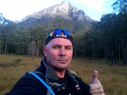
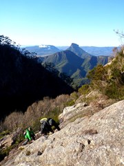
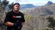
Mt Barney - East Peak - Up South-East - Down South

Mt Barney National Park

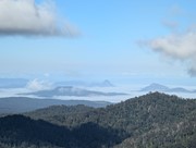
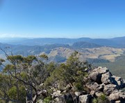
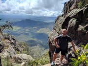
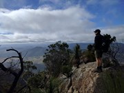
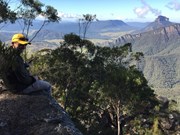
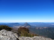
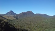
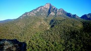
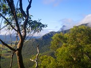
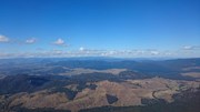
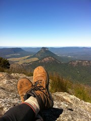
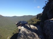
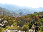
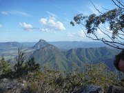
Ascent of Mt Barney via South East Ridge and descent via Peasants Ridge: a challenging but rewarding hike. The views are amazing and certainly worth the effort. If coming from Brisbane leave early and aim to be at Yellow Pinch car park by 7:30-8 am. Allow 3-4 hours for the ascent via the South East Ridge track and 2-3 hours for decent via South Ridge (Peasants Ridge) track.

Lookouts
Scrambling or Climbing
Navigation Required
Camping Permitted
Eucalypt Forest
1351m
Maximum Elevation
1100m
Total Climb

Getting there

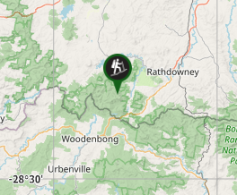
Access from Yellowpinch picnic area on Upper Logan Rd (enter "Yellowpinch" into GPS/Apple Maps and NOT Mount Barney!)

Maps

1:25K Mt Lindesay topographical map (Sun Map)
You can create a bespoke topographical map which can be downloaded as an image or PDF at QTopo

Route/Trail notes

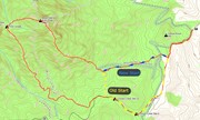
13/08/18: Updated with new South-East Ridge trailhead info (image attached showing changes)

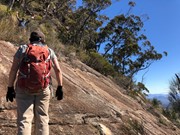
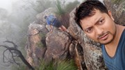
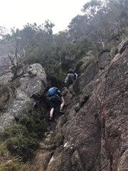
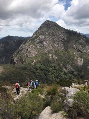
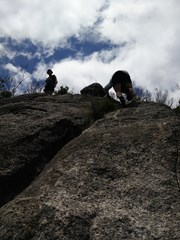
Start at the locked gate on the access road at the back of Yellowpinch carpark. Go around the gate and follow the gravel road uphill to Yellowpinch, go through the metal gate at the top and start walking downhill along the same gravel road. When you reach the bottom of the hill (approx 800m into the walk) there will be a cleared area on your right and you will see the NEW South-East Ridge trailhead; it is marked by a National Parks information board. Head along the path through the grass/shrub, cross the Logan River creek and then continue along the footpad up the steady incline. Approx. 1.5km into the walk you will reach an intersection; left going downhill and right continuing up the incline. This is where you join on to the traditional SER track. Take the right uphill, the incline will increase noticeably as the real ascent now begins. Continue along the footpath; when you come to a rock outcrop go to the right and keep heading up hill. At the next outcrop go left then right, where you should end up on a narrow ridge. Keep going up until you come to a steep deep gully go down and heading to the left climb an obvious route up. Keep going up past a razorback ridge. Where after a while you will come to a shallow gully where you head uphill to the right to a rocky slab that is a bit slippery so be careful. Keep going up hill follow the trail until another steep section and rock slab. Keep going and the summit soon comes into view. Keep going uphill with a few scrambles to the top of a rocky knoll. I found I reached here in about 3 and half hours from Yelllowpinch and followed the faint trail through scrub uphill to the summit.
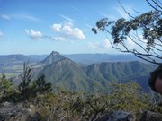
Once you finish enjoying the summit head west and downhill for about an hour aiming for the faint circle of the old Barney Hut There are obviously many different descent routes some over rock slabs some down gullies. Generally follow a south by south west bearing.  Once at the Campsite cross the creek and move uphill to Rum Jungle Campsite. The route out goes uphill with some arrows showing the way. After 10 mins or so the route descends. Keep the rocks to your left as the track steeply descends a narrow rocky ridge. When you descend to a small clearing the trail turns right then left and keep going down till you come to a steep rocky slab that can be slippery. Descend this carefully! keep following the path downhill till you reach the sign at the beginning of Peasants Ridge. Follow the road to the beginning of SE Ridge and retrace your steps back to the carpark at Yellowpinch. This walk was done when the weather was good and rock dry.

Permits/Costs 

If you camp anywhere in Mt Barney National Park, the cost is $6.15.

Other References

Take A Walk In South East Queensland. Rob Rankin Secrets of the Scenic Rim

https://hikingtheworld.blog/2018/07/08/mount-barney/

Comments

Walked out of camp at Mount Barney Lodge at 7:15am. Starting at the lodge added an extra half k each way. Fine on the way in, on the way home...not so much. Very hard and exposed walk/climb. The exposure in places was far greater than expected and i was glad to be facing the rock, unable to see what was behind me. Advice, if you suffer vertigo, proabably take south ridge. Steep climbing to false summits can be disheartening, but adds to the challenge. Very glad the rock was dry and would probably throw in 10m of rope for the next ascent. Was lucky enough to have 2m of prussik cord in my pack (just long enough) and used it on a slippery boulder scramble. The descent on the south ridge was much easier and now have plans for a camp in rum jungle and an ascent of the west peak. Great view, challenging walk.

WorldWalker on 20 Jun, 2012

Very hard track as it is such a consistant angle. The rock slabs weren't too bad at all to climb up slowly. Didn't get to each peak as we had lost a bit of time earlier in the day. Beautiful weather and only a couple of other people on the track

jen on 6 Aug, 2011

ANZAC Day hike saw it quite busy. And wet.

We got lost at the first main scramble, spent about an hour trying to find a path before we remembered/realized that you had to go up the crack in the ridge. The weather was cloudy and lots of little spurts of rain, made the second/smooth rock scramble quite difficult. Luckily with 5 of us in the group we could boost and pull everyone up. Next time though, I'm definitely taking at least 10 metres of rope to help.

I saw a lot of people descending via South East Ridge, which I've never tried of before. But they seemed to think it was easier.

When we did make it to the top, clouds were rapidly rolling in, making the descent to Rum Jungle a blind one in the white out. Bumped into a few other hikers in the same situation and we all ended up quite north of rum jungle and had to climb back up.

With all of our setbacks we finished the last 5 kms of the hike in pitch black. It was quite the ANZAC Day adventure. For anyone who has never done this before, make sure you are plenty prepared and have lots of extra supplies. If we hadn't the previous experience on this hike (3 newbies, but 2 people who had done it multiple times before) it could have ended quite badly.

Allan Allport on 25 Apr, 2011

Great way to spend easter friday, but went up peasents an down, it was a gruelling 10hr non stop walk/scramble to the summit where we spent 15minutes and took some photos, got down to the road out just on dark, glad we were prepared and had head lamps, 4 more kms to go in our wet socks and shoes, but loved every minute of this long day

Walkinghawk on 22 Apr, 2011

My first time up mt Barney was an overnighter ,carrying the extra gear was a real pain but the sunrise was worth it. The second time was up the South East Ridge and although hard it's an interesting climb.

mika28au on 14 Apr, 2011

Third time doing it for me, maybe one of the hardest. The slabs were slippery due to recent rain but the day was perfect.

One of my co-hikers got a stick in the eye about half way up South-East and could barely see. It took us the full 8 hours with him limping between us. But still amazing

Allan Allport on 27 Nov, 2010

Barney in cloud climbing should not be allowed. It was wet,cloudy and damp! But... Oh what fun!

Laurence Hallam on 1 Oct, 2010

Challenging but rewarding. Great preparation if you are thinking about trekking the Kokoda Trail in PNG

Sarah White on 29 Apr, 2010

The walk started at 3.30am to beat the heat. A long tiring but enjoyable walk!

Laurence Hallam on 13 Feb, 2010

I found this a more interesting and enjoyable trail than the Yelllowpinch track as, although consistently steeper, we felt like we made faster progress upwards. Also the ridges and gorges we passed we far more interesting - including and awesome echo at one stage.

Tim on 20 Feb, 2005

Have done both of these around 6 times each..... love it, especially camping in rum jungle overnight.

Lynney on Sometime...

Where
Click here to load this map.
Nearby Walks

Done this walk?

This walk has been ticked 170 times

Aussie Bushwalking can keep track of your bushwalks.

Login/signup to tick this walk off.

Tick walks to keep track of where you've been. You must Login to tick walks. Accounts are 100% free so sign up if you don't have one.