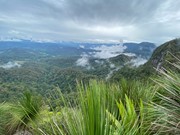
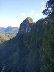
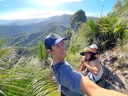
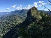
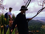
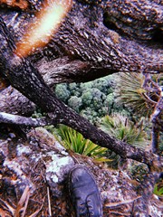
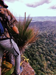
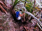
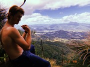
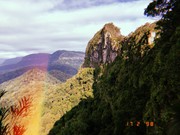
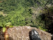
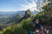
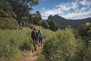
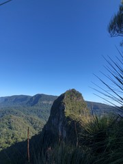
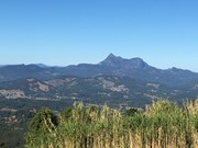
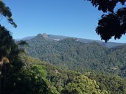
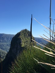
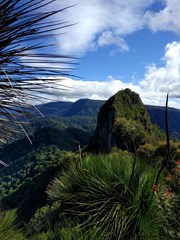
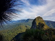
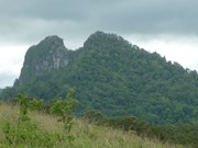
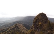
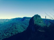
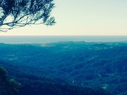
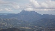
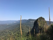
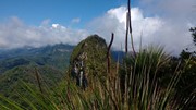
A walk along the border fence line to the twin summits of Mt Cougal. There are excellent views from the top!
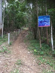
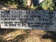
It is hard for beginners. Make sure you check weather. Finding location is a little hard. When arrive see steel gate that states ‘please keep gate clear ta’ On side of gate you can enter, when pass the gate look to your left and see sign with with instructions. Don’t be discouraged when you start, it is a little scary, but it gets easier, but still lots of hill. Follow the barbed wired fence on your left the whole way. The track will go from very narrow to comfortable in some places. Once you reach the last 700 metres or so... it becomes much harder. You will see a thin rope to guide you - do not use this to pull you up as it will break!! You will come to a spot where the track will seem to end. Look for a tree that has arrows etched into it to guide you where to go. There’s also a small pink ribbon tied to a tree branch Up further. You have to go up! It’s hard but worth it.

Scrambling or Climbing

Getting there

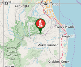
Turn into Stewart Road, exit 95 from the M1. Turn left into Currumbin Creek Rd after about 1km. After about another 7km turn left into Tomewin Mountain Rd. after about another 10km pass through the Border Gate. Turn right into Garden of Eden Rd, about 1km from gate. Drive for about 4km to a gate with a few carspaces. Park Here. 

Maps

Sunmaps Springbrook 25000 

Route/Trail notes

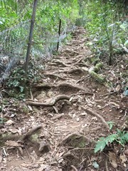
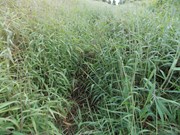
Hop the locked gate (actually, you can walk around it) and follow the path immediately on the left uphill. The barbed wire fence commences here on your left, lantana on your right and sugarcane on your left in patches further up. Do not follow the obvious track straight ahead of the gate! If you see a bunch of abandoned shacks you have gone the wrong way!! After fighting through some serious folage (the path is majorly overgrown for the first hour) at the top of this hill you are rewarded with views of the Tweed Valley and the coast. In fact, garters, long pants and ideally a machette should take care of the basic requirements to continue on this walk. :) The high folage is wet in the mornings requiring hiking boots to avoid soaked feet. On the return (if you choose that option), once the sun hits it, it becomes sticky with a billion small pricles finding every piece of exposed skin! Nonetheless, if you can get past the folage, after the first hour, the track becomes well worn, shady without the high grass. You will be walking on a relatively easy rainforset track for a while.

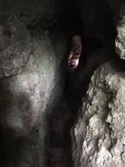
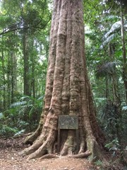
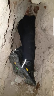
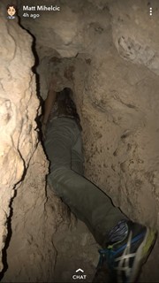
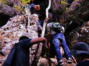
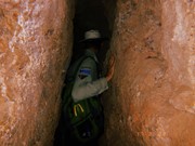
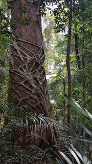
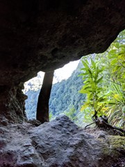
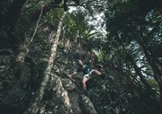
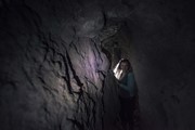
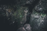
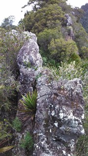
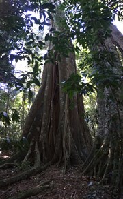
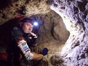
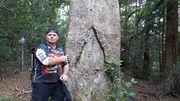
The track winds its way through the rainforest, heading up and downhill along the border fence. You will enter a cleared area with a large tree in it this which was marked by the surveyor Roberts in the 1860's. Keep following the fenceline which will eventually start to become a relatively steep uphill scramble. Walking poles (or some stray sticks) to assist with both the up and decend would be great here if you don't have the fancy onces, pick up a stick early on in the rainforest path before it gets steep (they are usually gone when you start looking on the steep bit). The track is marked in some places with pink ribbons and arrows carved into the timber where it gets a little confusing. After a long uphil climb (notably without further head high grass) veer right and look for a path to a narrow cave. You can Squeeze through the Cave and there is a book to sign on the other side in the opening in the cliff-face - but note that you have to return through the Cave.  Keep veering right after a visit to the cave untill you find a steep rocky gully where you need to scramble up the cliff. If you look closely, someone has been kind enough to carve an arrow into a tree trunk to point out where to start climbing. The very first few steps are the hardest. After that it's pretty easy going for the final 5 minutes to the peak / lookout. At the top, on the left of the track is a lookout twoard the west. To the right goes to Boyd's Butt and finally to the sawmill at Cougal Cascades. Turn left and walk to the Summit of East Cougal.

To climb West Cougal locate the track that heads downhill steeply, descend a 3m cliff  to the right and a tree to the left. When you reach the saddle. Follow a narrow ridge take the track to the RIGHT. As you climb uphill steeply locate a track that goes to the left. I marked this point for the return. Follow this track uphill to the small clearing at the top. There is a lot of vegetation to push through. there are limited views here.

To return simply retrace your steps.  

Permits/Costs

Spring brook Camping $5 in National Parks.

Other References

Rankin: Secrets of the Scenic Rim, Daly:Take a walk in South east Queenslnd. 

Comments

The trail was quite overgrown which certainly adds to the difficulty of this walk, in saying that don't be put off doing the trek it's really really worth while getting to the eastern summit. It's very step getting to the final climb which is also not that easy to find. Thankfully I got some great tips here. So when you get to the base of the eastern peak traverse to the right it's a reasonable way round, keep looking for the tape markers on some roots and branches that lead the way to the summit then climb very carefully. Once again don't get put off but the push for the summit is not for the faint hearted.
Along the way you'll see plenty of snake holes and as well as a few snakes a bit of local wildlife. For most of the walk you are in constant contact with the flora, long sleeves and leg protection will make your life a lot more comfortable in the days following this walk.
I wasn't at any stage concerned about losing the trail it pretty much follows the fence line. That fence is your friend and guide as long as you know where that is you'll be fine. Have fun and be safe

lee~midds on 23 Dec, 2015

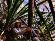
JUST BACK FROM MT COUGAL BORDER WALK.THE TRACK SEEMS TO HAVE IMPROVED FROM SEVERAL YEARS AGO SO I FOLLOWED MY NOSE UP TO WESTERN SUMMIT THIS TIME.REGARDING THE EASTERN AND WESTERN PEAK APPROACHES,THE EASTERN SUMMIT IS STEEP AND STRAIGHT FORWARD [NOT EASY]HOWEVER THE FOLLOWING WESTERN SUMMIT PRESENTS A COUPLE OF GENUINE CLIMBING SECTIONS WHERE THERE IS NO ASSISTANCE.WOULD NEVER GO UP THERE IF IT WAS WET AND ALSO COMBING BACK DOWN IS JUST AS BAD IF NOT WORSE, BE CAREFUL OF LOSING THE TRACK ON THE RETURN,IT SEEMS PEOPLE ON THE CLIMB HAVE MARKED UP MANY PATHS THROUGH THE GIANT LILIES .THE HIKE TAKES TIME EG.6 HRS MINIMUM FOR RETURN WALK TO GARDEN OF EDEN GATE UNLESS YOU WANT TO SPRINT UP AND BACK..THE TRACK IS MARKED WITH TAPE/RIBBONS INTERMITTENTLY IN DIFFICULT SECTIONS ...WHAT I FIND CHALLENGING IS THAT THE BORDER TRACK CONTINUES ON FROM WESTERN COUGAL SUMMIT WESTERLY TOWARDS SPRINGBROOK...ANYONE KNOW ABOUT THIS TRACK?

halomansion on 18 Nov, 2015

Completed both peaks 01/11/2015. The track overall is mostly easy to follow all the way up to east peak. Then the small distance to West peak becomes a challenge. Constantly stopping and taking a few seconds to look behind you and remember which way to go on the return will help, along with spotting any ribbons placed around the place. The heavy foliage could easily land you in a dangerous spot.
Incredible fun however, cane fields, cave, old growth rain forest, spectacular views, rock scrambling and bush bashing. Its all there. One of my favourites now. Pro-tip: Wear zip off pants as the grassy/lantana area can be unpleasant when it has grown over..

dalehikes on 1 Nov, 2015

Walked the track this morning, great views it was a perfect day and the track was pretty good. Make sure you wear long pants and shirt as there are lots of burrs and prickles along the way but overall I had a great first walk and hope to complete many more.

Dizzygill on 14 Jul, 2015

Did the East and West peaks in Spring, 2014. Loved the scrambling over to West peak. Total trip was 5hrs return with a half hour lunch break with a group of 5 moderately experienced hikers. The track in was well-worn up until the national park starts. No snakes, easy to navigate and no need for long pants/protection in the track's current state. Scrambling amongst the giant lillies was a highlight, but they're not in flower yet (at the time of writing). Some of the grass trees are magnificent. Going to camp at the top of West peak next time - perfect spot up there!

Andrew Carter on 6 Sep, 2014

Great Climb ! If walking through long stretches of VERY long grass is not your thing .. avoid ! We perservered through this, and glad we did. Seeing the old Surveyors marker was quite special, but the cave was the highlight for me. After the cave, we climbed to the top to capture some great pics of the awesome view. As you approach Mt Cougal, the track indeed becomes quite steep. If you brave the cave ( you should ) look for a smaller cave inside FULL of glow worms.

DrummerJeff on 10 May, 2014

Went only half way today as was very overgrown. As I was walking in the middle of a hot day by my self I thought Id come back when its cooler with few less reptiles. Fine to get through the trail though.... up to where I saw anyways

Ty on 6 Oct, 2013

Went only half way today as was very overgrown. As I was walking in the middle of a hot day by my self I thought Id come back when its cooler with few less reptiles. Fine to get through the trail though.... up to where I saw anyways

Ty on 6 Oct, 2013

Track is quite overgrown. Halfway turned back, might try again with pants and long sleeve top

Rob on 10 Jun, 2013

Awesome walk. Not a hike as I remember but hard to find. For serious walkers only. Couldn't find the cave. Would have been interesting

Watflo on 29 Mar, 2013

An enjoyable walk however I would recommend heavy duty gloves, it is very tempting to reach for the barb wire fence in the steep sections. The views from the top were magnificent. I have a great respect for surveyor Roberts and his men who made this climb in the 1860's carrying their surveying equipment.

OurLinx on 26 Aug, 2012

A good walk once the first half hour is out of the way. Make sure it is during the dry season August/September. It is not an easy track despite being fairly short. Make sure to wear sturdy boots and a walking pole is useful. Also remember the ventolin if you are asthmatic as the track gets quite steep. Don't take your SLR camera with a big lens it will only get in the way. Plenty of birds and terrific views of Currumbin and Mt Warning

DaveKIng on 25 Aug, 2012

A nice walk with stunning views. Just had to get over my phobia of crossing locked gates.

Laurence Hallam on 2 Oct, 2010

Where

Click here to load this map.

Nearby Walks

Done this walk?

This walk has been ticked 185 times

Aussie Bushwalking can keep track of your bushwalks.

Login/signup to tick this walk off.

Tick walks to keep track of where you've been. You must Login to tick walks. Accounts are 100% free so sign up if you don't have one.