Dularcha NP - Roses Circuit

Sunshine Coast

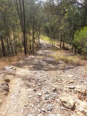
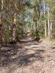
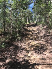
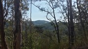
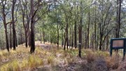
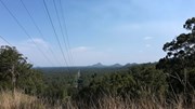
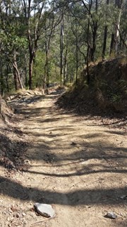
This multi-use recreation trail passes through dry sclerophyll forest and rainforest gullies and includes some views south to the Glass House Mountains from the top of the ridge (206m). Eucalypt forests and riparian areas with flooded gums, cabbage tree palms and rainforest plants feature here and provide habitats for a diversity of wildlife. Birdwatchers will enjoy the diversity of birds along the trail early and late in the day. Definitely take a copy of the map or a GPX file on GPS as lots of crossing tracks which can be confusing

Lookouts
No Dogs Permitted
Horses Permitted
Cycling Permitted
Eucalypt Forest
224m
Maximum Elevation
202m
Total Climb

Getting there:

From the Bruce Highway, take the Glasshouse Mountains Tourist Drive (aka Steve Irwin Way) turn off.

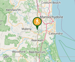
Continue along Steve Irwin Way until you reach Landsborough, for the southern entrance off Beech Road. (Latitude: -26.795340, Longitude: 152.965210). Southern Entrance to Dularcha National Park / Tunnel Trail

The northern entrance at Dorson Drive (Latitude: -26.771640, Longitude 152.963760), is off King Road in Mooloolah. Don't take Paget Street, as this no longer links with Dorson Drive. Northern Entrance to Dularcha National Park / Tunnel Trail

Maps:

Department of National Parks, Sport and Racing

Dularcha National Park Map

Route/Trail notes:

As the track is poorly marked, it is recommended you print off a copy of the map from the 'link' above. All the side tracks are marked as 'no horses', which gives you some clue to stay on the main track!

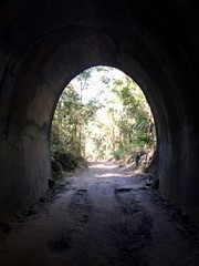
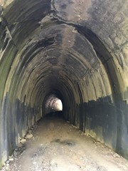
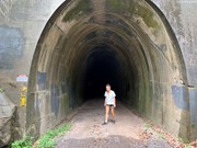
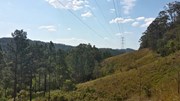
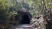
The track can be accessed from the north above the Tunnel. There is a horse track on the left of the tunnel up to it. From there, turn right and follow to the top of the ridge, past the first electricity pylons and turn left downhill at the second. From there, it is a steep decent to the junction of Gully Track, turning right back to the Tunnel Track, left again and back via the tunnel.

From the south, the track is signposted left about 1.2km along the Tunnel Track. Ignore the tracks to your left and right till you reach a fork junction. Turn left downhill before a steep accent to the top of the ridge where there is the electricity pylons. Turn right on the ridge, ignoring any tracks to your right, until you are above the tunnel and turn right down onto the Tunnel Track and back to your start.

Permits/Costs:

None

Other References/Comments:

The side track of Connection, Ridge, Gully and Myla have not been walked. They are noted as not suitable for horse, so could be pretty rough. They do however all lead back to the Roses Circuit. 

Additional comment; I've walked Myla and Gully Tracks, Myla is quite steep but I wouldn't call either "rough".   I suspect horses are limited to the main track (Roses Circuit) to leave the cross tracks and side tracks for walkers and bikes.  

Comments

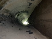
Great little walk... a little muddy. quite steep in parts. the tunnel has little bats flying around which is cool (my girlfriend was a bit freaked out though)

Hogey Bear on 20 Feb, 2024

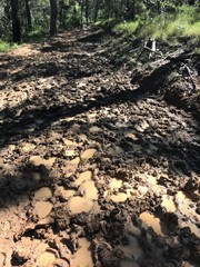
The thickest mud I ever saw, the tunnel with the bats was a bit much personally but walked through anyway. This got the blood pumping with the incline and a some steep moments on loose gravel.

Forbsey on 20 Feb, 2024

I left from the southern end (closest to Landsborough) and walked Roses Circuit clockwise. It is fairly steep in parts and I had to stop in sections to catch my breath. As noted by others, there is loose gravel and easy to fall on your bum when going down hill.

I did check the map a few times to ensure I was on the right track as it's poorly signed but had no issue with getting reception.

I finished Roses circuit and made my way back to the southern end. Took me about 2hours 18 mind and covered 8.18km.

Beth on 10 Sep, 2023

Did Roses Circuit and the Myla Track starting from Pagent St but did it clockwise going through the tunnel first. Found this to be quite beneficial as there were a lot of steep hills we descended on the way back which would need a moderate to advanced fitness levels if you did it anticlockwise. Whilst it was lacking in spectator views one expects on a similar Glass House Mountains walk, it was still enjoyable with plenty of variety in scenery with a couple of nice views down the valley cut through for the High Voltage powerlines. For me it is a one time only walk.

Paul on 11 Dec, 2021

I've walked in Dularcha NP twice, both times from the southern entry. First time I did Myla Track, second time I did Roses Circuit cutting across Gully Track. Myla Track is very steep and loose gravel in places, so much so that on one downhill section I figured I had the choice of sit down or fall down - chose the former and went down on "all fives". Back on Roses Circuit it's not so bad. The western section beyond Gully Track is the highest/steepest part so if you prefer a shorter, not-so-steep walk go Roses Circuit and cut across Gully Track. That still has uphill sections but bypasses the worst of it. If you're after a workout go the full Roses Circuit including Myla Track.

Jim Craigen on Aug, 2020

Walked in from Landsborough end, raining from start to finish which made the track slippery in places. Up hill & down dale all the way,tunnel is good,seen a couple of very small bats. No real views but pretty pleasant walk overall.Take a copy of the map as lots of cross tracks can be confusing

Bribie 61 on 28 Jun, 2020

Great training walk. Steep sections. Rainforest beautiful in the drizzle.

Anonymous on 20 Jun, 2020

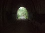
Walk itself was nice, no particularly spectacular views, nice rainforest though. Tunnel was pretty cool.

Karla on 28 Dec, 2019

Got a bit off the track somehow and followed a faint trail through the bush and found my way back to the main track. Some nice inclines and the tunnel is interesting.

Chris M on 5 Sep, 2019

Great alternative to the tunnel track with a bit more exercise and a slightly longer walk. Stick to the track that is suitable for horses and you can’t go wrong. We got slightly lost by not sticking to the suitable for horses track but regained the main track after a scramble up hill.

Bobbe on 14 Aug, 2019

Great shady walk , quite steep in places and muddy after all the rain.

Whinger on 5 May, 2019

The path was easy to find and follow. Very wet and made it very difficult on mountain bikes with soft mud in parts and slippery tracks on the steep sections. Took one of the cross through connection trails which was a lot better than the main trail.

cyade28 on 20 Apr, 2019

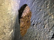
Did the roses circuit starting from Dorson Drive and then in a clockwise direction which meant we got to go through the tunnel right at the beginning which was good. Spotted the purple moths and tiny bats in the caves and also some frogs along different sections of the track. Found the route quite easy to follow as we were using ‘maps.me’ app which has all the different paths on there.

Sophie on 2 Mar, 2019

Nice walk. Few steep hills but douable for everyone. The view and scenery is not the best but its a nice track.

Fata on 17 Feb, 2019

Nice little walk, not many views from the track, but there are few little sneaky off shoots you can take to look into the valley. Good little challenge to build up fitness. If you walk through the tunnel look for the uphill track at either end of the tunnel that will take up to roses trail.

Samantha on 18 Aug, 2018

We started our walk at Dorson Drive Mooloolah. The tracks are not clearly marked, so glad we took a printed map with us. Part of the Roses circuit is not accessible, near old Maleny Road due to being overgrown with vegetation, we nearly got lost had to turn around and backtrack back to Gully track. We walked approx 10kms and 2.5hrs. Tracks were steep in places and there were places that were very muddy, also lots of horse poo has lots of rider use these tracks. Overall we had a good day and enjoyed the walk.

Marisa on 15 Jul, 2018

Nice walk...track is rough and very steep in places...makes that cold beer at the end of the day more rewarding :)

Richard Williams on 14 Apr, 2018

My husband and I mountain biked this track. There has been a lot of rain and hence the track is extremely muddy. The tunnel track is not too bad, but when we climbed up to the Rose circuit it was about 30 cm deep mud for at least 100 metres with horses riding on it, churning it up even more. We gave up and just returned to the start after cycling just 6km.

SparkySparkler on 7 Apr, 2018

The roses circuit track was really good for someone who wanted to get in some steep uphills/undulating track. There are views along parts of the walk but not panoramic. The tunnel is super cool - I tracked 12km with Roses circuit and tunnel walk combined. Recommend.

Museum of Jus on Mar, 2018

Was looking for something different to my usual and came across the Rose Circuit. Took about 3 hours with some very steep hills just before the half way mark. Also some sections of trail with long grass (not a lot of track maintenance). Would agree with suggestions to take map as trail markers are few and far between (I did have wifi coverage the whole time but better safe than sorry). Historic rail tunnel is pretty cool and many beautiful butterflies, moths and birds, but not a track I would regularly walk as there isn't much besides bush viewing.

Cassablanca on 23 Apr, 2017

Where

Click here to load this map.

Done this walk?

This walk has been ticked 53 times

Aussie Bushwalking can keep track of your bushwalks.

Login/signup to tick this walk off.

Tick walks to keep track of where you've been. You must Login to tick walks. Accounts are 100% free so sign up if you don't have one.