
Menu
Popular Walks
-
Dove Lake Circuit
(99 ticks) -
Wineglass Bay
(85 ticks) -
Cataract Gorge
(71 ticks) -
Overland Track
(56 ticks) -
Mount Amos
(55 ticks)
Sub-Regions
- Bruny Island
- Cradle Mountain-Lake St Clair National Park
- Dip River Regional Reserve
- East Coast Tasmania
- Franklin-Gordon Wild Rivers National Park
- Freycinet National Park
- Maria Island National Park
- Mount Field National Park
- Mt Roland face walk
- Reynolds Falls Nature Recreation Area
- Southwest National Park
- Tasman National Park
- Wellington Park
- West Coast Tasmania
Summary
With 3 UNESCO sites Tasmania sure has it's fare share of walks and lookouts.
Popular Walks
-
Dove Lake Circuit
(99 ticks) -
Wineglass Bay
(85 ticks) -
Cataract Gorge
(71 ticks) -
Overland Track
(56 ticks) -
Mount Amos
(55 ticks)
Sub-Regions
- Bruny Island
- Cradle Mountain-Lake St Clair National Park
- Dip River Regional Reserve
- East Coast Tasmania
- Franklin-Gordon Wild Rivers National Park
- Freycinet National Park
- Maria Island National Park
- Mount Field National Park
- Mt Roland face walk
- Reynolds Falls Nature Recreation Area
- Southwest National Park
- Tasman National Park
- Wellington Park
- West Coast Tasmania
Other Information
UNESCO Sites
- Tasmanian Wilderness
- Macquarie Island
- Darlington Probation Station
Contact details
Tasmania Parks & Wildlife Service
http://www.parks.tas.gov.au/
Regions
...
Walks in Southwest National Park

 6.1
km
return
6.1
km
return
 4
hrs
4
hrs
Mount Sprent
Starting on the dam wall above the Serpentine River you very steeply climb up towards the summit of Mount Sprent with amazing views.
 16
km
return
5
hrs
16
km
return
5
hrs
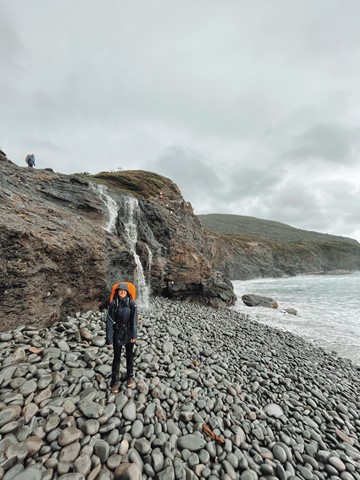
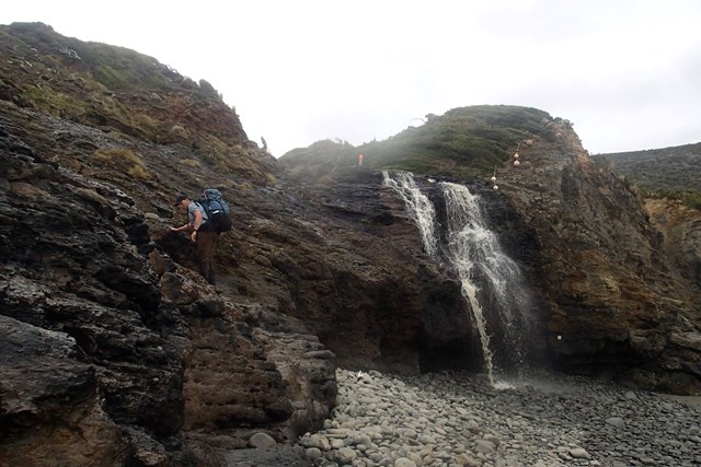
South Cape Bay Track
This is a 16km return walk from Cockle Creek to South Cape Bay. This walk is the most southerly day walk you can do in Australia! When you arrive at the rocky headland, you are looking south to Antarctica but it is still many kilometres south. About 4,000 kms in fact.
85
km
one-way
7
days
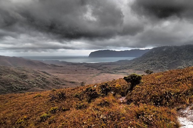
South Coast Track
The 85km South Coast Track runs between Melaleuca and Cockle Creek. There are no roads to Melaleuca, so walkers must either fly, sail or walk in and out.
Most people take about 6 to 8 days to complete the South Coast Track, depending upon time spent enjoying the beaches. Walkers should note that the track surface may be rough and muddy over extended sections.
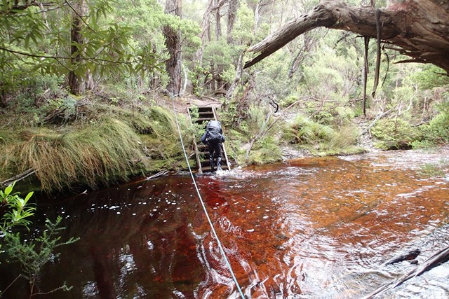
Boat Crossings
There is a water crossing that requires walkers to use small boats at New River Lagoon. Extreme caution is needed when making crossings, particularly in windy weather. You should carry a couple of days extra food to allow for delays.
Track conditions
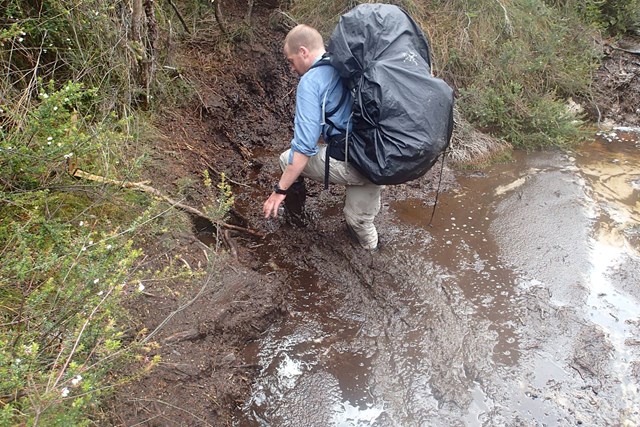
When crossing the Ironbound Range, note in one day the track goes from sea level to 1000 m above sea level, and back down again. It’s a very full day. Start from the campsite right at the base of the Ironbounds. The South Cape Range is half as high as the Ironbound Range, but equally difficult. It's a rough and muddy track. Start from the nearest campsite and expect a full day. Note that there's no creeks for most of the Ironbound Range and the South Cape Range.
There is no reliable fresh water at the campsite at New River Lagoon crossing. Most other creeks marked on the map are big enough to be flowing even in the driest time of summer.
If you want to visit Osmiridium Beach, be aware that the turnoff is not obvious and many people walk past it. Look for a little path meeting the track.
At South Cape Bay, there’s no track down to South East Cape (the southernmost point of the continent.) There’s no point leaving the South Coast Track to reach it as it’s an impassable coastline. When walking along narrow or rocky beaches at high tide, beware of large wave swells.

 2.4
km
return
2
hrs
2.4
km
return
2
hrs
The Needles Track
A nice short but steep walk to an interesting summit with good views.
 53.2
km
return
6
days
53.2
km
return
6
days
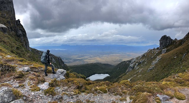
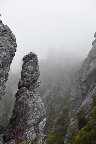
Western Arthur Ranges
Incredible Walk - Partial Traverse Length (exit via Kappa Moraine aka Moraine K)
Walks in Tasman National Park
10
km
4
hrs
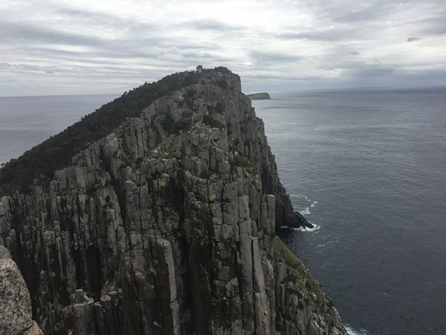
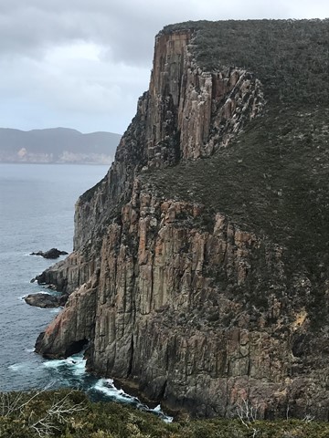
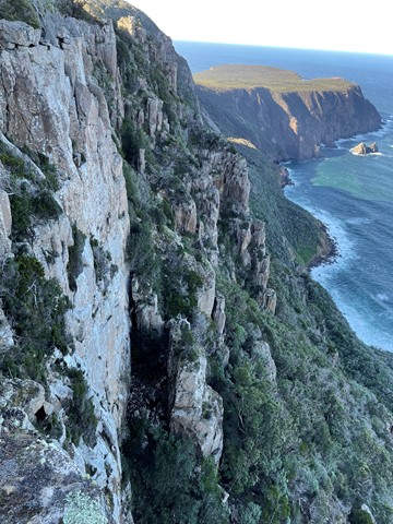
Cape Hauy
The walk provides some magnificent views of the Tasman Peninsula Coast with high cliffs and spectacular rock formations. A very enjoyable walk from Fortescue Bay on a well marked track
 4.5
km
return
2
mins
4.5
km
return
2
mins
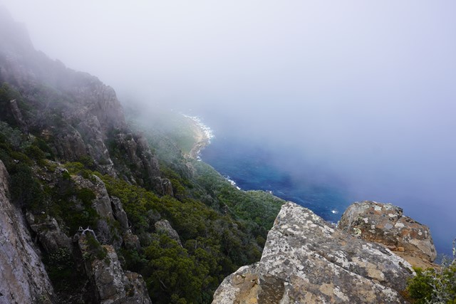
Cape Raoul Lookout
A shorter walk instead of the big one just to the lookout of Cape Raoul.
 9.2
km
return
3
hrs
9.2
km
return
3
hrs
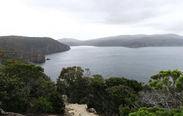
Crescent Bay Track to Mount Brown
A lovely coastal track to a nice beach and the impressive Mount Brown with 360 degree views.
17
km
one-way
7
hrs
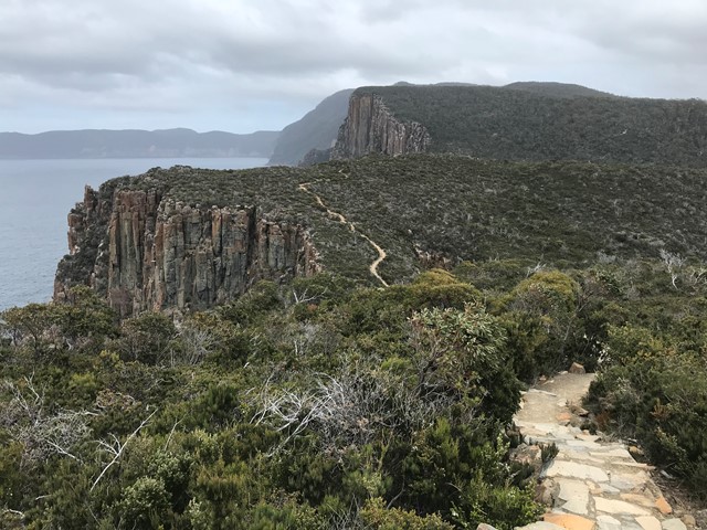
Fortescue Bay Hike
This is day two of the three capes hike. Today the group will hike 17 Klm's and take up to 7 hours. You will see great views from cliff tops go through rain forests and if your lucky see a water fall. By the end of the day you will need a long soak but feel elated with what you have accomplished.