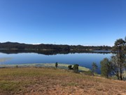
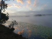
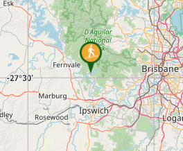
Starting and ending at the day use area, this is a clockwise loop in the hills around Lake Manchester through a conservation park adjacent to the D'Aguilar Range National Park (Brisbane Forest Park section).

Bird Watching
Picnic Facilities
BBQ
Toilets
Horses Permitted
Cycling Permitted
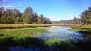
Swamp or Wetland
Eucalypt Forest

Getting there

Lake Manchester day use area is near Kholo, about 25km west of Brisbane off Lake Manchester Road. This is well signposted from Mt Crosby, west of Kenmore.

The last section of road is gravel, but well maintained.

Maps

A location map is available on the DERM website (PDF) with the trail map here. A sign outlines the route at the start of the walk also.

Route/Trail notes

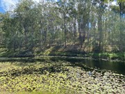
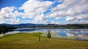
It starts up past the dam wall, and for a time follows the lake shoreline before climbing up into the ridges. For most of the walk the lake itself is not visible.

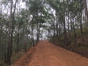
The route uses forest/fire roads which are well graded but a covering of loose gravel means caution must be taken on descents. The trail is very hilly with some testing steep sections.

Most of the walk is through open eucalypt and ironbark forests with plenty of birdlife. Each intersection is signposted to remind you to turn right, without distances to the next feature. One sign towards the beginning of the trail going clockwise indicates that the trail continues up a hill, but it ends and goes nowhere so it is better to follow the shore.

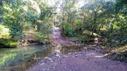
SEQwater signs warn that water should be boiled/treated before drinking so bring plenty of water. There are a few creek crossings but these are seasonal and for most of the year will be dry.

Sections of the track are shared use with horse riding and trail bikes.

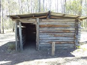
The loop passes a small hut but for the most part is open with some shade provided by trees.

Camping is allowed at the Blue Gum Flats campsite which is reached on the walk. This is a large flat grassy area surrounded by forest but has no facilities. Bookings are required via DERM and the site may be closed periodically for regeneration and during the wildfire season.

The final leg of the walk is along Lake Manchester Road as the trail does not lead directly back to the BBQ area. As a variation here it is possible to keep to the ridge above the lake on the boundary of the paddocks by climbing through a locked gate on the right of the main track. You will find this about 50m after you pass the locked road gate with the trail map at around 15km (you will still need to get back onto Lake Manchester Road for some of the walk regardless, through the railing fence at the end)

Permits/Costs

None required for the walk, and access is free. Booking is required via DERM for camping at the Bluegum Flats.

Other References

None.

Comments

Exhausting! Long and lots of hills. Take some walking sticks and leave really early. DO NOT go in summer. Not much shade so cover up and wear/bring sunscreen. We saw a red belly snake and some other wildlife. For most of the track there is no view of the lake. The lake is pretty though.

Clem on 31 Aug, 2023

Lake Manchester is on Jinibara Country. This walk was really gorgeous, and took us about 4 hours and 20 minutes walking time at a fairly steady pace with a few stops to take photos and drink water. We took the counter clockwise route, as the clockwise option had a ankle-depth stream covering the pathway and we chose not to risk wet feet from the beginning (although of course we did have to walk through this stream at the end). There are some very steep inclines, followed by very steep descents, some of which are incredibly slippery even with hiking boots. These were balanced with a lot of flat walking time in between. I do think this walk requires a moderate level of fitness at minimum, and for us it was just the right mix of challenging without being overly difficult. The walk is well marked, most of the pathway is covered by a nice amount of shade from gumtrees, and there are really stunning glimpses of Lake Manchester for many parts. At about 15-16kms out of 17kms in total, we stopped to have a picnic by the lake, which was really peaceful and gorgeous.

Babs on 23 Aug, 2021

Lake Manchester is quite a beautiful area 25km West of Brisbane and just a short drive from Ipswich CBD.

The start of this hike is at the Lake Manchester Day Use Area.
Here you will find picnic ground's, bbq's and a toilet block.

I would highly suggest to hike this track clockwise as you won't have so many steep hill's at the end.

This loop is advertised as 17km but today I totalled 18.9km.

This hike will take you along a wide, dirt, slippery fire trail and is fairly well signed.
If you just stay right at the forks and always have the lake on your right, you will be ok.

You have view's of the lake at the start of this hike and towards the end but will mainly pass through hot scrub with not much shade.
I crossed two creek's today and it was lovely to see the scenery change from bush to a bit cooler rainforest.

Around the 5km mark you will pass an old log hut before crossing the first creek at around 6.5km.

There isn't a lot of place's to sit and have a break until you reach a campground at around 11km.

When you start thinking you have absolutely had enough of all the steep hill's another one is thrown at you at around the 14.5km.
A few F 💣's were dropped believe me 😳

Please choose your time of day wisely. This is a very hot bushwalk so please take plenty of water. I drank 2lt. There is no mobile reception so make sure someone knows where you are.

Overall I actually quite enjoyed this hike. It definitely tested my endurance.

Enjoy 🙏💕

Instagram:--- misslissy79

Mel on 7 Mar, 2021

17km with a large number of ungraded hills is definitely a heart starter. The distance and time are accurate and we finished in just under 4.5 hours of walking so it is very achievable even with only moderate fitness. We walked clockwise and found most of the hills in the first half of the walk which was nice.

Bobbe on 2 Jan, 2021

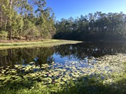
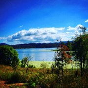
I did not expect much and was pleased by what I got. Peaceful, some nice views over the water with the mountain range as backdrop, water lilies, plenty of butterflies, two trickling creeks and a bit greenery in the bush after recent rains. Well maintained day use area. No regrets. It's dry aussie bush after all.

Wanderlust on 28 Dec, 2020

Nice walk in the rain. Quite muddy in parts and some steep sections that get the heart going. Really enjoyable.

MacDiggity on 28 Jun, 2020

This is a tougher a walk then lead to believe ...I would class between a medium and a high ...not a medium walk. There are quite steep sections especially before you get to the log cabin which is about 6 km from the car park area. I would suggest a reasonable amount of fitness for this walk.

There is a peacock that hangs around the toilet and barbecue/recreation area ...and be aware that he often takes shelter in the male toilet and may give you quite a fright.

Loki on 18 Jun, 2020

Great walk with friends in 3hrs 45mins. Enjoyed the views of the lake at the beginning of the circuit and definitely agree with previous comments about doing it clockwise. Randomly, there was a peacock hanging out in the carpark area who seems to be quite friendly.

Nadine on 7 Jun, 2020

3h 40m. Much warmer than expected, glad to have taken extra water, but nice breeze towards the end. Good workout especially with the steep sections at the start.

spiggytopes on 17 May, 2020

Go early before 7am.
Take 2L water per person at least.
Go clockwise.
Took us 3h19mins.
Pretty boring but good training loop.

Jameyk on 24 Oct, 2019

Pretty much a 17k version of the Enogerra Dam walk. The views of the lake and the lily pads are quite beautiful but by the end of the hike, you've seen enough half-dead grass and gum trees to last you for a lifetime. I did the track clockwise as recommended but I took the first trail to the left. This was a super steep trail that dead-ended at the top of a mountain The left turn I was meant to take was further on. Apart from that, I navigated the track without any mishaps. The log cabin is about a third of the way along the track and is a great place to stop and have lunch. About two thirds along the track you come to the Blue Gum Flats camping area. In the final leg of the walk, you get to pass several farming properties but unfortunately, you don't get to see much of the lake, When the car park finally comes into view you can breathe a sigh of relief. Saw some interesting birds on the walk, like red-backed wrens, red browed finches and the yellow-tailed black cockatoos. Certainly would not do this walk in summer!

Jeff on 1 Sep, 2019

Long and boring but a good training loop. Would hate to be out here in summer!

Wez on 1 Aug, 2019

Nice hike

HelenR on 22 Apr, 2019

Long, hard walk. Definitely recommend leaving early (I started 7am, finished back at the rec area car park 11am on the dot) as it was getting quite hot by the last leg of the trail. Agree with some other users: this walk made a great training hike to prep for other longer hikes and it's not very scenic. Gorgeous wildlife though - I came fairly close to a few huge lace monitors along the way.

Jane Mousley on 17 Jan, 2019

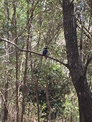
Definitely do this clockwise. Head straight for the dam on the left of the wall. I was worn out on the hills at the end and had a fall. Much water was required. Saw blue kingfishers and the birds were singing all day. Nice longer walk but make sure you have non skiddy shoes.

HellsBells on 20 Oct, 2018

Long hard boring walk. Whoever called this trek "medium" has got to be joking. Darn hilly. Plus whoever designed the road forgot there's a lake nearby. Glimpses of the water are almost non-existent, and at times you're miles away from the lake. And how hard would it be to put a milestone every so often. Also thanks to the lady who gave us a bum steer towards the end of this ordeal and made us walk a further 3 km. Next time we'll do an easy walk...like Mt Warning!

Lawrie on 1 Oct, 2018

Harder than I remembered, especially in the rain.
Went clockwise to get the harder hills done first.
The first stream has a good set of stones to act as a bridge, but at the second (near the campground) they move a lot. I ended up hurting my knee and getting wet shoes - not a fun combo, so beware.

TJ on 14 Apr, 2018

I would rate this Hard and not Medium. Our first mistake was probably that we headed anti clockwise.. boy did we regret that when encountering those massive hills near the end. If I were to do this walk again would go clockwise and get those hills out of the way earlier. Second mistake was not taking enough water, was not prepared for how long it took to walk the track, the hills really slowed us down and of course we drank more water. Third mistake was not leaving earlier in the day, we headed out around 10.00am and during the hotter time of the year, if Id known then what I know now would have left closer to 7am when it is cooler. Don't expect beautiful views of the water during this walk, mostly bush. A nice walk overall but would have been more enjoyable if left earlier, took more water and headed clockwise.

Janelle on 2018

HOT! Really hot. Take plenty of water. We ran out of water but thankfully the stream near the hikers camp was running so we just got a couple of extra litres and treated it. A decent training hike but not sure I'd do it again.

Leith on 17 Dec, 2017

https://ofsoutheastqueensland.wordpress.com/2017/11/13/lake-manchester/
Here, I wrote a longer recount of my walk on this trail, and me and my companions' experiences around the lake. I think it's interesting, so maybe check it out of you're inclined.

This was a nice longer walk, with some interesting and pretty parts and much varied bird life.
Going clockwise, not too far from the beginning of the track a sign will point with an arrow up a hill. Going this way proved to me and my small group to be a waste of time, because the trail disappeared. It seemed to continue past the sign along the lake to the rest of the trail. Without distances marked on them, I'd say the signage on this trail is poor.

meadharry on 11 Nov, 2017

Where

Click here to load this map.

Nearby Walks

Done this walk?

This walk has been ticked 107 times

Aussie Bushwalking can keep track of your bushwalks.

Login/signup to tick this walk off.

Tick walks to keep track of where you've been. You must Login to tick walks. Accounts are 100% free so sign up if you don't have one.