
Menu
Popular Walks
-
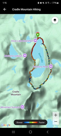
Dove Lake Circuit
(99 ticks) -
Overland Track
(56 ticks) -
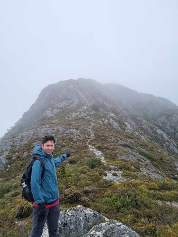
Cradle Mountain Summit
(51 ticks) -
Marions Lookout
(38 ticks) -
Wombat Pool
(36 ticks)
Parent Regions
Summary
Cradle Mountain-Lake St Clair is one of the most well known and popular National Park in Australia. Host of the world famous Overland Track, the park is located in the Central Highlands region of Tasmania 165km north-west of Hobart. The park includes Mt Ossa, the highest mountain in Tasmania, and Lake St Clair, Australia's deepest lake, amongst a multitude of features.
Popular Walks
-
Dove Lake Circuit
(99 ticks) -
Overland Track
(56 ticks) -
Cradle Mountain Summit
(51 ticks) -
Marions Lookout
(38 ticks) -
Wombat Pool
(36 ticks)
Parent Regions
Features
Without a doubt the Overland Track is the most famous walk in the park. Arguably the pinnacle of Australian bushwalking, the Overland Track is 65km long and generally takes 5-6 days but is often extended with side trips along the way.
The park also has numerous easily accessed day walks at both Cradle Mountain and Lake St Clair, as well as opportunities for visiting other areas of the park with some more effort.
Major features of the park include Cradle Mountain, Dove Lake, Barn Bluff, Mount Pelion East and West, Mt Ossa, Pine Valley (including the Labyrinth and the Acropolis), and Lake St Clair.
Maps
TasMaps has a series of topographic maps that cover the park in detail.
Accommodation
There are multiple private accommodation options at both Cradle Mountain in the north and Lake St Clair in the south. Within the park there are public and private huts and camping areas though restrictions apply on their use.
Contact details
Parks & Wildlife Service websites:
Cradle Mountain - https://parks.tas.gov.au/explore-our-parks/cradle-mountain
Lake St Clair - https://parks.tas.gov.au/explore-our-parks/lake-st-clair

 5
km
return
5
km
return
 2
hrs
2
hrs
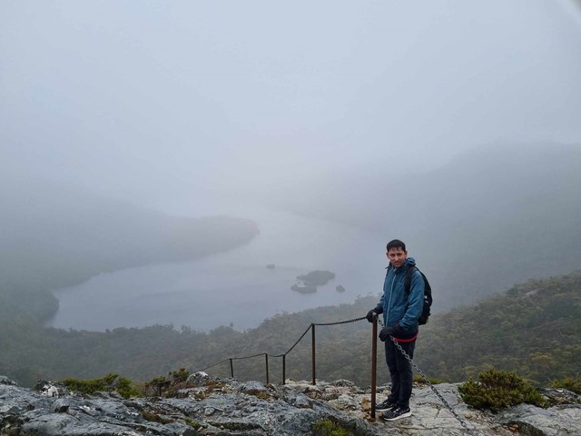
Hansons Peak
Hansons Peak is directly across Dove Lake from Marions Lookout and provides fantastic views of Cradle Mountain and Dove Lake. Other features seen include Lake LIlla and Lake Hanson and on a clear day through to Mt Pelion East in the distance.
 2.3
km
return
1
hr
2.3
km
return
1
hr
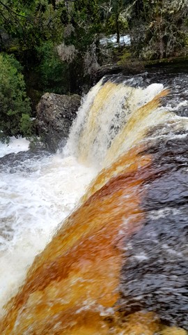
Hartnett Falls
Follow the trail down to the top of Hartnett Falls. From here the trail follows the cliffline downstream before hooking down to the river. From here depending on water levels you can go right out to the base of the falls.
45
mins
Knyvet Falls
This short walk near the Cradle Mountain Discovery Centre and Cradle Mountain Lodge passes through myrtle rainforest to a viewing platform at the top of Knyvet Falls. A short side track also leads to the base of Pencil Pine Falls. Perfect for those looking for a shorter walk in the Cradle Mountain area.
 3
km
one-way
1
hr
3
km
one-way
1
hr
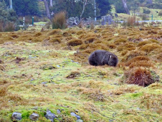
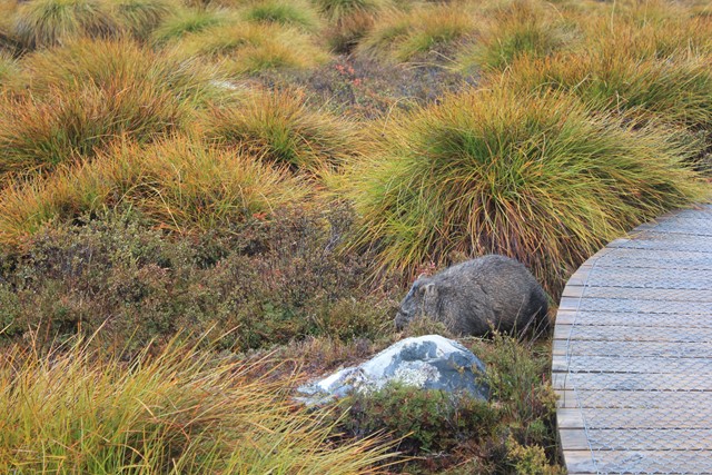
Lake Lilla Track
Walk between Dove Lake and the Ronny Creek carpark past Lake Lilla at Cradle Mountain. Lucky walkers will find wombats feeding beside the boardwalk in the Ronny Creek valley.
 3
km
return
90
mins
3
km
return
90
mins
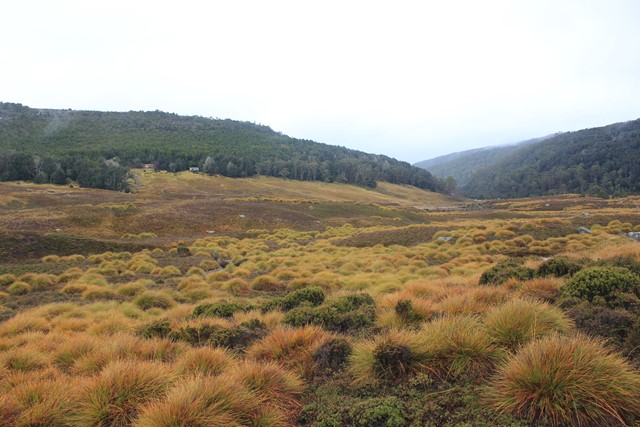
Lake Will
The walk to Lake Will is roughly 3km return although if you follow the overgrown path along the edge of Lake Will for roughly 5.1km return all up you can make it out to Innes Falls.
Little Hugel
A panoramic view of Lake St Clair, Mt Olympus, Mt Byron and Mt Hugel from the top of a rocky peak. A lesser-walked track but one that combines great views with some alpine lakes and rainforest areas.
 7.5
km
return
3
hrs
7.5
km
return
3
hrs
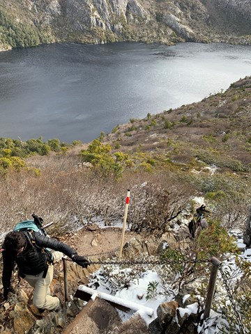
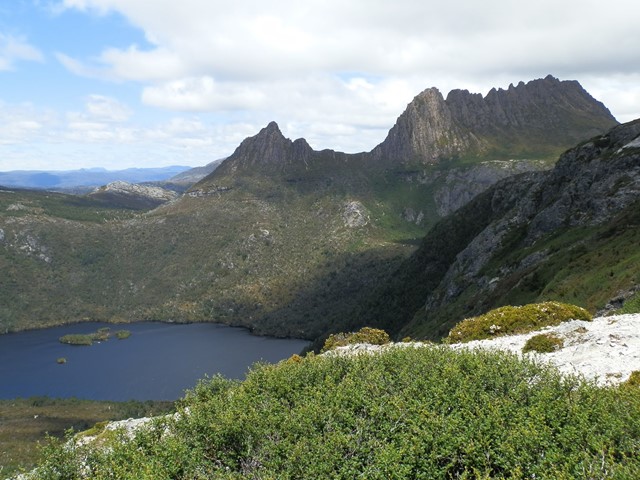
Marions Lookout
High on the western side of Dove Lake, Marions Lookout provides breathtaking views to Cradle Mountain and over Dove Lake and Crater Lake.
 4.5
km
return
2
hrs
4.5
km
return
2
hrs
Mount Campbell
A short but steep walk to a broad summit with uninterrupted 360 degree views of the area.
11.4
km
return
4
hrs
Mount Oakleigh
To reach the true summit of Mount Oakleigh an 11.4km side trail is required although the first East peak can be optained via a 7.8km return hike or a 9.8km return hike can be made to the commonly obtained false peak which places you above the famous Oakleigh spires.
2.4
km
return
2
hrs
Mount Pelion East
The far more civilised Pelion is still a worthy walk offering a lot of bang for buck. A short side trail leads sharply up the shoulder from Pelion Gap before a short little scramble up the nunatak summit.