
Menu

 6.3
km
return
6.3
km
return
 3
hrs
3
hrs
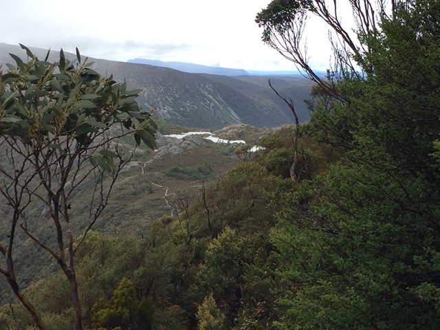
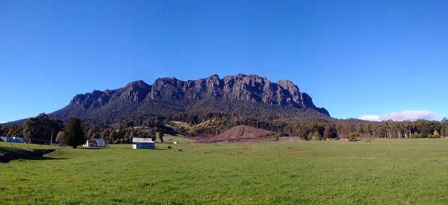
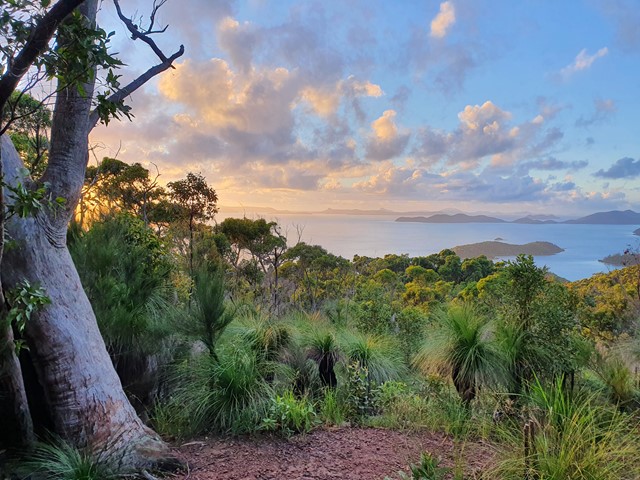
Barn Bluff
A side trail from the overland track often completed on day 1 or the morning of day 2. Barn Bluff is the 4th highest mountain in Tasmania and makes for a fun scramble with good views.
65
km
8
days
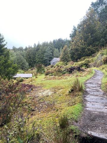
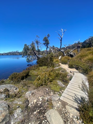
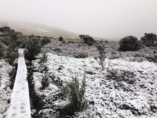
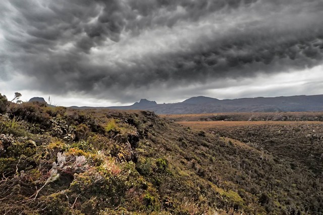
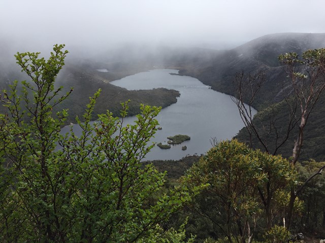
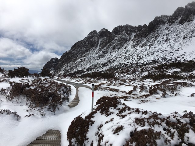
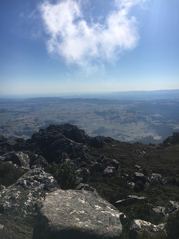
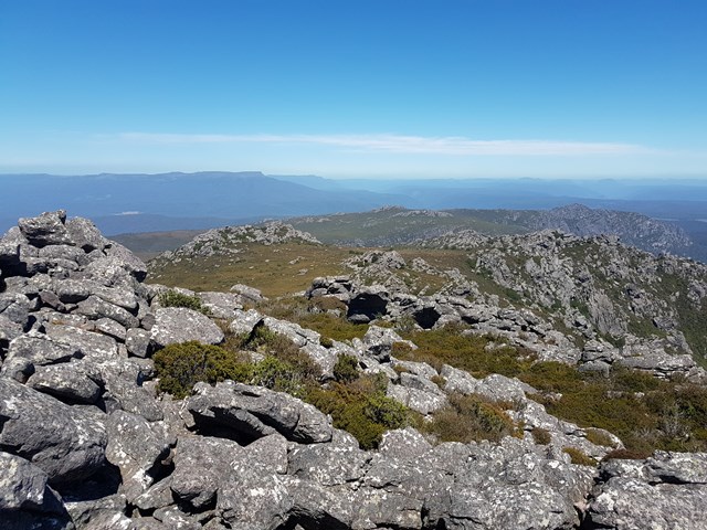
Overland Track
The best-known, and arguably best quality, bushwalk in Australia, the Overland Track traverses the finest of Tasmania's wilderness: rugged mountain peaks, wild alpine moors and deep forests. With a series of side-trips available, no two trips are the same.
 5.6
km
one-way
3
hrs
5.6
km
one-way
3
hrs
Cradle Valley Boardwalk
A trail consisting mainly of boardwalk like the name suggests that serves as a link between the ranger station and ronny creek. The trail runs up the Cradle Valley with Dove River to the left and the road to the right.
2
km
one-way
1
hr
Face Track
A track along the northern face of Weindorfers Tower and Little Horn, two of the summits of Cradle Mountain.
 7.4
km
return
3
hrs
7.4
km
return
3
hrs
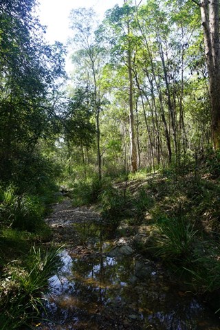
Liffey Falls from Lower Liffey Reserve
A lovely walk through lush forest from the camping area following Liffey river to the collection of stunning Liffey Falls (theres at least three major falls don't stop at the first). To visit all the falls and return is about 7.4kms while its about 8.9 to the far carpark and back. The falls can be accessed via a shorter walk from this car park.
8
km
one-way
6.5
hrs
Mt Roland
Located near Sheffield, on the edge of the Great Western Tiers region of Tasmania. Looks quite ominous as you approach from Sheffield with its many sheer cliffs. A good day walk that is easy to follow, with a large portion of the walk done across the plateau along to the summit. The path has branches off to the other mountains near by (Mt Van Dyke, Mt Claude), but the Mt Roland track is much better maintained.
 3.5
km
return
90
mins
3.5
km
return
90
mins
Liffey River Bush Heritage Circuit
A Bush Heritage Australia walk that takes you along through lush forest and offers views of the Liffey River.
 1.4
km
return
1
hr
1.4
km
return
1
hr
Oura Oura Reserve Track
Oura Oura is the aborigial name for Yellow-Tailed Black Cockatoo and the property is the former home of Bob Brown and holds a significant place in the history of the Wilderness Society, the Greens and Bush Heritage. Those keen to stretch their legs further can set off up Drys Bluff.
5
km
return
2
hrs
Cataract Gorge to Duck Reach Loop
Continue upstream of Cataract Gorge's first Basin to witness more of the gorges beauty and some hydro history.
 7
km
return
2
hrs
7
km
return
2
hrs
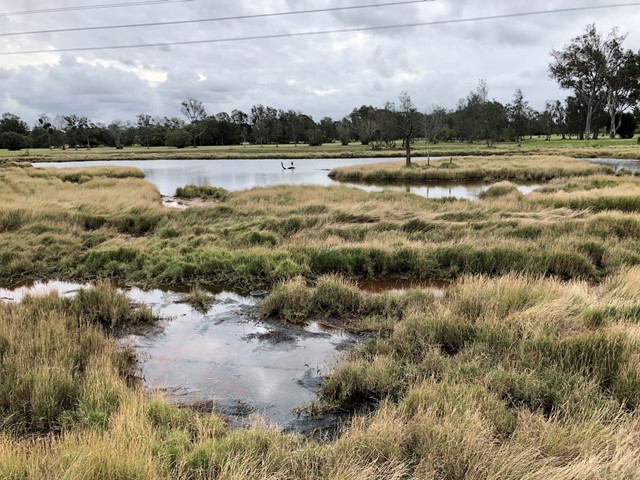
Jim Soorley Bikeway and Wetlands
A shared bike way along the Schulz Canal into a wetland area with plenty of bird life.
 7
km
return
2
hrs
7
km
return
2
hrs
Birnam Range
Walk along the spine of the Birnam Range. The trail along the range stretches for 7-8kms starting in the South from the end of Monmouth Ct or the main Mundoolun Road and finishing in the North at Currawong Ct. Outlined in this walk is a section of the trail along the highest part of the range starting from and returning to Mona Dr which is one of a few additional enterance points.
3
km
return
1
hr
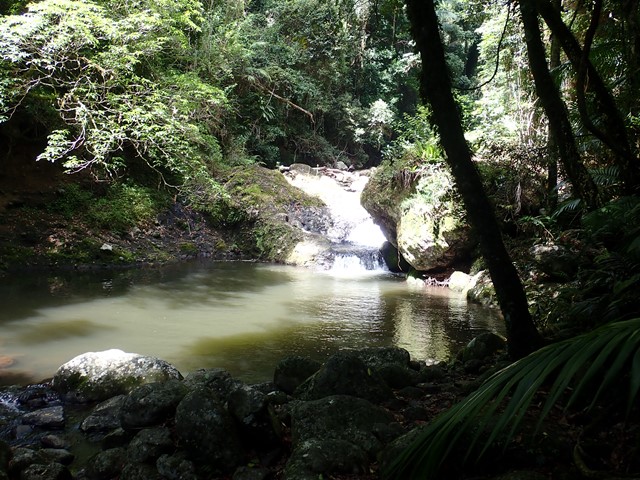
Mt Walsh Waterfall Creek (Utopia Falls)
This pleasant moderate grade walk to the rock pool area—a nice place to picnic, cool off in the shade beside the rock pools or just enjoy nature.
The walk begins in hoop pine dominated dry rainforest and vine thickets fringing a moist gully. Further on, open forests and grassy woodlands feature and merge into shrubby heath along Waterfall Creek.
The creek cascades through a series of rock pools that have potholed into the granite by years of water erosion. Cabbage palms, (Livistona decora), growing near the rock pools occur here at their most western limit. Further along Waterfall Creek, impressive water gums, (Tristaniopsis laurina), grow to over 25m high and wrap buttressed roots around rocks.
Look for wildlife as you walk. You might see wonga pigeons in the dark shaded understorey of the rainforest or catch a glimpse of white-throated treecreepers in the open forest and woodland. Swamp wallabies also use the track and red-necked wallabies often feed around the rainforest fringes.
Caution is required when accessing the creek as rocks may be slippery and unstable.
 7
km
2.3
hrs
7
km
2.3
hrs
Mt Rooper/ Swamp Bay
An excellent walk on well made linked tracks to the top of Mt Rooper and Swamp Bay in the Conway National Park.
 3
km
return
1
hr
3
km
return
1
hr
Curlew and Ironbark Circuit
Wide tracks but plenty of medium difficulty up and down as you criss cross ridges and creeks. Downhill can be a bit slippery on the gravel.
 14
km
return
4
hrs
14
km
return
4
hrs
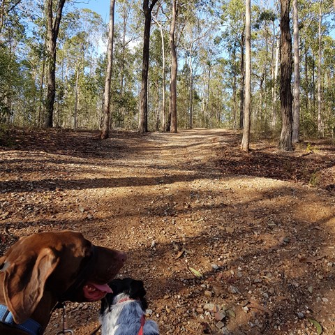
Holmans break
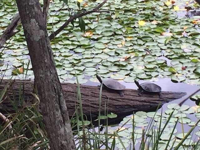
This is a beautiful walk around a large section of the bushland in which Enoggera Reservoir sits. You will walk through lots of varied vegetation, keep an eye out for goannas, lots of different birds and turtles sunning themselves on a log in the dam. A great way to spend 4 hours! I do recommend that you have a map - you can purchase the topographical map from Walkabout Creek.
Start out from the bottom carpark at Walkabout Creek, take the small track to the far right that follows Mt Nebo road. There is a very steep hill right in front of you! Follow this track for about 2 km, (turn around every now & again and you will catch glimpses of The Brisbane City skyline), The track will split - stay on the track that is to the right, still following Mt Nebo road, which is also on your right (you can't really see the road) for about another 1km. You will come to a bit of a clearing under the power lines - turn around and enjoy the view out over The Gap!
There are great views of Mt Cootha on your left and the mountain range in the distance (that I don't know the name of!). There is quite a steep descent down to a beautiful creek - take some time to enjoy a rest here as there is a VERY steep ascent ahead of you! It's probably about a 600 metre climb, which will bring you out under another power tower. Look over to the next tower - that is where you are heading! Continue along the trail for about another 1 km and you will come to a T junction, stay left for another couple hundred metres to another junction - go left again onto Fire Break 69. Don't forget to look over to your left when you reach the power tower and see how far you have come! Continue down Fire Break 69 until you reach another junction - this is McDonalds Loop. We went to the left and followed it down to the end where it hooks up to the Enoggera Reservoir loop - again we went left and followed the trail back along the reservoir to Walkabout Creek.
 50
km
return
2.5
hrs
50
km
return
2.5
hrs
Northern Rivers Rail Trail - Tweed Section
A 50km return walk or cycle along the old rail line between Murwillumbah and Crabbes Creek.
3.3
km
one-way
90
mins
Baxter Falls - Northern Approach
This walk leads through open eucalypt forest, dropping almost 300m down to the suspension bridge across Baxter Creek and the Falls to your left. The water falls into a 'bowl', before cascading into the bottom of the creek. Access to the 'bowl' is thought to be by bush bash to the left, but was not tracked.
 19.7
km
return
4.5
hrs
19.7
km
return
4.5
hrs
Carrolls Creek Loop
Trailhead at Bald Rock day use area.
Walk includes Little Bald Rock and two creek crossings (sturdy bridges). 4km are on the Bald Rock access road
 7.5
km
return
3.5
hrs
7.5
km
return
3.5
hrs
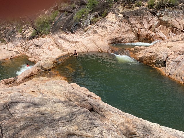
Westray's Grave from Christmas Creek
Hike from Christmas Creek to Westray's Grave along the South Branch of Christmas Creek. An enjoyable hike with obstacles to traverse to reach Westray's Grave. A chance for a swim on a hot day! Return trip is approximately 3-4 hours depending on conditions.