Mt. Mathieson Circuit

Main Range National Park

This track was built by volunteers in 1986 from the National Parks Assoc of Qld. The mountain is named after the chief commissioner of railways from 1880s to 1912

Lookouts
Scrambling or Climbing
No Dogs Permitted
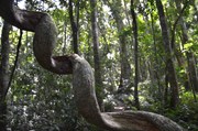
Rainforest
Eucalypt Forest
836m
Maximum Elevation
489m
Total Climb

Getting there

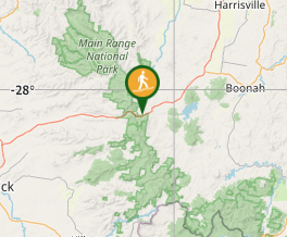
From Brisbane follow the Cunningham Highway through Aratula towards Cunninghams Gap. 5.4km after Aratula turn left onto Lake Moogerah Rd (signposted Lake Moogerah and Spicers Peak). 5.8km later turn right onto Spicers Gap Rd. Follow this road another 6.5km into the National Park and park on the left at the Pioneer Graves Picnic Area, just past the campground.

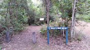
From the Pioneer graves carpark go towards the Mango orchard and where the Spicers gravel road starts to go up. there are signs on the right to the beginning of the track.

Maps

Main Range

Route/Trail notes

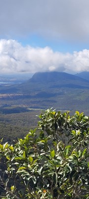
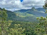
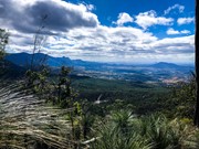
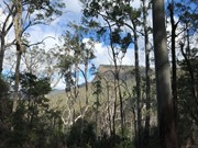
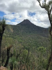
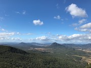
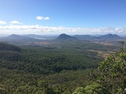
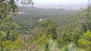
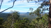
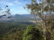
This is a must-do walk, fantastic views of Mt. Cordeaux and Mitchell and when at the governors chair the views are endless. The track is well marked and starts next to the orchard on the opposite side of the road to the car park.

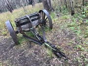
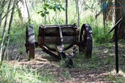
I would start from the track entrance then walk to the top of Mt. Mathieson. While walking across the top towards Spicers gap be careful of several large rock falls then traverse an break in the canopy across

 to an old timber jinker. From here keep following the track to the carpark then turn left and follow the historic road to the Governors Chair. Make sure to make the short detour to the amazing Governors Chair lookout.

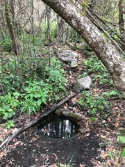
After finishing at the lookout return to the road and follow it for the final leg downhill through bell birds and whip birds to Moss's Well (a 60m side track) and then continuing back to the campgrounds.

The gravel road is extremely difficult after rain so wait a few days after rain before driving on this gravel road. 4 wheel drive vehicles will have no problem on this road.

There are toilets and non-potable water there. If you have some type of water filtration you could have an extended stay at the campgrounds.

Permits/Costs

Only if you are camping there is a self registration site.

Other References

Call local NPWS Main Range

GPS Tracks

Comments

Nice and not very exhausting walk. A lot of wildlife.

ovel on 26 Nov, 2023

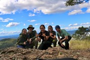
I went with a group of friends on this trail. It’s very enjoyable to do, not difficult at all but I would say medium grade is appropriate as it is a fairly lengthy track. You go through so many different ecosystems - swamp, bush, lush rainforest, grassland, etc can all be found here. We started at the orchard opposite the graves and ended up at Governor’s Chair Lookout which was spectacular. I recommend this trail for a nice easy day out.

Warlock Bride on 18 Jun, 2022

Overall a very nice walk, a bit of everything- rainforest, scrambling, open eucalypt forest and great views. First approx 1km (from mango orchard / pioneer picnic area entry) very wet and overgrown with weeds, ankle deep swamp for stretches. (Beware stinging weeds!) Still easy enough to follow track though. Middle (2km to 5km) very beautiful and less overgrown from here. Great walk! Took us 4 hours (slow start through swamp and lots of stops). Red browed finches near end on heritage trail were a highlight.

A Binks on 29 Jan, 2022

Moderately easy hike along a well defined trail. Most of the way it’s single file and a little overgrown but we had no trouble following it. Overall not too steep although a couple of short scrambles where the path uses the natural rocks. Glad I wore my gaiters because it was quite wet after the thunderstorm last night. Spectacular views from Mt Mathieson towards Cunningham’s Gap, and at the other end of the trail from Governors Chair towards Moogerah Peaks National Park.

Olwyn on 16 Jan, 2022

It was a lovely walk but the path is starting to get a little overgrown and most of the way you can only walk single file. there were a few patches that required scrambling but they were not too difficult. Watch out for snakes, we spotted one on our hike.

Melissa on 1 Jan, 2022

Third time for this walk. I walked it 12 months ago, and noted the fires and drought had taken a heavy toll on the bush. It was nice to see the regeneration that has happened in the last 12 months. Very enjoyable walk.

Brian on 23 Oct, 2021

Not a bad Sunday walk with lovely views from both Mt Mathieson and Governor's Chair Lookout.

ozsailor on 12 Sep, 2021

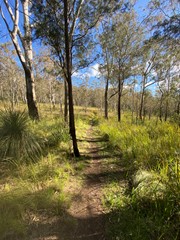
This is a nice walk with plenty of great views and Lace Monitors. Clockwise would definitely be my suggestion so as to finish with The Governor's Chair but either direction would still bring perks as the view north over the H'way is also spectacular. The track is well marked and the bush has a good variety, with eucalypt and rainforest, both.

Kelso on 10 Sep, 2021

Easy walk through pleasant scenery

samkramer on 29 Aug, 2021

This was an enjoyable walk and offered great views of Mt Mitchell and Mt Cordeaux. The track was clearly delineated and easy to follow. I wouldn't describe it as a physically challenging walk, but rather a moderately or slightly difficult one- certainly no problem for the average fit person. Governor's Chair just 80 m off the track also offers fantastic views and is a great place to have lunch.

Jeff on 12 Jul, 2021

All the overgrown sections of this track have now been cleared and it's quite straight forward, although there were a few newly fallen branches to step over. We started at the orchard and did the whole circuit, taking just over 3 hrs including short stops for photos and snacks. We're both between 65-70 and didn't find it too arduous - mind you it was a cool day with some drizzle. I love this walk for its changes of vegetation and fabulous views at the top. There were plenty of birds around and also what I think was a pademelon.

Helen on 25 Jun, 2021

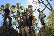
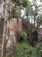
Took 2.5 hours walking but 5 hours in total with all the little stops we did to look at stuff. Rock scrambling was a bit more intense than we anticipated but easily done. Some areas are very overgrown. Our tracker recorded that the track is 10.5km in total

KLEEWDO on 11 Apr, 2021

Today we hiked the picturesque Mt Matheisen circuit 🥾

You will find this hike about 5km out of Aratula, turn left onto Lake Moogerah Road for another 6km then turn right onto Spicers Gap Road and the National Park entrance is about another 6km up this dirt road. It is suitable for all cars, just be careful in a low clearance vehicle 🚗

Mt Matheisen is a part of the Spicers Gap section of Main Range National Park and is a part of the Gondwana Rainforest's of Australia World Heritage Area.
We parked at Pioneer Graves Picnic Area and the start of the hike is directly across the road.

This circuit includes Mt Matheisen, across the ridge to the heritage trail, over to Governor's Chair and then back down to the picnic area 🦋

Today we hiked just over 9km and took around 2 hours and 20 minutes ⏰

This hike was such a pleasant surprise 🌿🦋🌻⛰

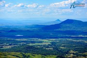
You will encounter scrub, magnificent views of Mt Mitchell and Mt Cordeaux, rainforest, a little rock scrambling and some inclines to get the old heart pumping and leg and bum burn happening 🍑🔥

At the moment this hike is VERY overgrown and we did lose the track at certain points and nearly stood on one snake 🪱 We would personally say that signage is quite poor.

In saying this it made the day a real adventure and who doesn't love an adventure ❣

Overall this hike was such an enjoyable day and definitely recommended

Enjoy 🙏💕

Instagram:- misslissy79

Mel on 18 Feb, 2021

Didn't expect much from this hike but was pleasantly surprised. The track is a bit overgrown since after all the rain but still very easy to follow. Although the view from the top of the mountain is a bit obstructed the other views along the way make up for it. The walk has a lot of variety and even some very light scrambling.

Vonsnrub on 5 Feb, 2021

Lots and lots of weeds. Disheartening. The walk is a great loop though,

Anonymous on 9 Jan, 2021

I did this walk about 10 years ago. It was heart breaking to see the trees and bush that had died due to drought and fire since my last walk here. The bush is very dry and badly needs rain. That said, it was still an enjoyable walk. I walked the walk counter clockwise finishing at the Governors chair and then follow the road back to the day park area. The views from the Chair are spectacular.

Brian on 2 Oct, 2020

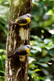
So many birds on this walk. Felt a bit disappointed by the large amounts of weeds on this trail post fires. Lots of different vegetation and good views of Cunningham's Gap and Main Range.

Jimcar on 29 Sep, 2020

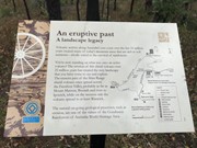
Walked this circuit this morning. Fantastic views of Cunningham's Gap and Mt Mitchell. A couple of steep sections just after Mt Mathieson but generally pretty easy. Completed in about 3 and a half hours with plenty of photo stops. Very interesting history of the area.

Foxy on 23 Sep, 2020

Took 2.5 hrs. We went while its cloudy and I wouldn't recommend doing that as all of the views suffered. Bird life was impressive. Governors chair lookout was very nice and you can drive there. This walk wasn't very stimulating for me.

Chesspeople on 11 Sep, 2020

This is a really nice walk for those that are building up to challenge the grade 5 difficulty walks. The walk is well worn and its hard to miss the track. The birdlife as others have said is abundant and a joy to the senses. Read the other comments - its all there. Enjoy!

Mark Whitford on 25 Jul, 2020

Where

Click here to load this map.

Nearby Walks

Done this walk?

This walk has been ticked 110 times

Aussie Bushwalking can keep track of your bushwalks.

Login/signup to tick this walk off.

Tick walks to keep track of where you've been. You must Login to tick walks. Accounts are 100% free so sign up if you don't have one.