Kureelpa Falls

Mapleton National Park

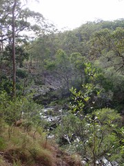
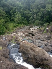
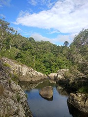
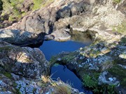
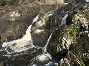
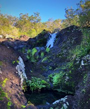
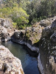
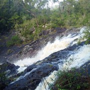
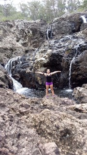
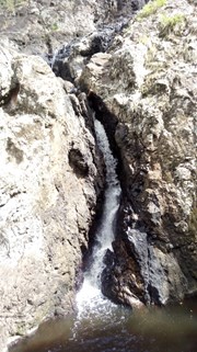
A hidden gem in the Mapleton National Park, with water from the South Maroochy River cascading over boulders before falling 30m into a hidden gorge.

Waterfalls
No Dogs Permitted
No Camping Permitted
Rainforest
242m
Maximum Elevation
58m
Total Climb

Getting there:

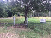
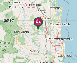
Take the Mapleton Road from either Nambour or Mapleton and opposite the Dulong Lookout at Kanyana Park turn into Kureelpa Falls Road. Follow the road along the ridge (great views) to its far end (last section is on gravel) where there is room to park before the gated access to the Park.

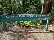
Alternatively, the falls can be reached via an 8.5km circuit starting from Mapleton NP Day Use Area.  From Mapleton take Obi Obi Road then right turn into Delicia Road then right again into Mapleton Forest Road.  The Day Use Area is clearly marked, as is the starting point for the walk.  The last approx 2km to the Day Use Area is unsealed road but any vehicle will be OK.  Beyond the Day Use Area Mapleton Forest Road deteriorates, the "high clearance 4WD only" warning sign should be taken seriously. 

Maps:

None found.

Route/Trail notes:

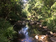
From the gate, follow the faint trail know as River Break through the long grass and after 600m you will come to a creek crossing, which would likely be well flooded after heavy rain. When dry, there are stepping stones to help you across. Follow up the far side until you reach the more defined track and turn right. Shortly you will see a sign down to the falls on your right, which you follow for 400m.

The alternative, longer walk from Mapleton Day Use Area is very clearly marked, just follow the route markings for walk number 4.  It's down hill pretty much all the way to the falls so no surprise it's up hill pretty much all the way back, though not overly steep.  Fine for those of moderate fitness, take your time and stop for a breather if necessary.  This is a park management trail, vehicle width all the way other than the 200m side-track to the falls.  Unlike the shorter route which has a creek crossing that could be flooded after rain, the longer route has drainage culverts at all creeks so the track will be passable even after rain. 

Permits/Costs:

None.

Other References/Comments:

The return walk is only an hour, but given the 'adventure' you can have while you are there, allow two!

Comments

Walked the shorter version & it had been pretty dry so falls were pretty quiet but you can see how big they would be after a downpour by the lay of the rocks.
Might walk in the long way next time & go after a rainy period

Bribie 61 on 10 Jul, 2023

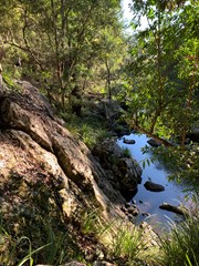
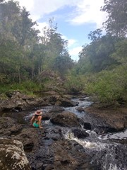
These falls are absolutly stunning and with a bit of rock hopping you can find a gentle stream to wollow in or places to stick your head under a fast flowing fall. Stand on the edge and look down the gorge. Fantastic!

It's a mistake to enter via the kuralpa falls road end if there has been rain or is likely to be rain. Having been to the falls before in dry, there is a track beside the river that takes you to the falls. Its a clamber down which in the dry is fine. From there you can rock hop and climb pretty easily to get across the falls and on to the main track. Way way too dangerous in the wet and with a big pack.

I turned back, clambering up to the track and to the easiest water crossing about 400m back. Got my feet wet and onto the main track. Was fun but starting from Mapleton is the safest way. The track was really lovely in the wet and long enough to test some new rain gear. Wide vehicle track, we'll signed with maps along the way. Because the rain became heavy I didn't go to the Mapelton day use but just did the, roughly 7km circuit. Well good for a short work with a bit to get the heart pumping.

S.C Hiker on 31 Dec, 2021

So lush 💧💧💧
Super lucky to have this all to ourselves today! A decent amount of water in the falls. Really fun to scramble around and rock hop up and down the creek, exploring some of the smaller rock pools and personal jacuzzis experience. Loved how quiet and private it felt with no one around!

We opted for the longer signed track from the day-use area. The walk to the falls was pretty easy as it is all downhill. A bit tiring walking back to the car park tho after a couple of hours swimming and up an incline but nothing major.

:) on 7 Mar, 2021

Walked the longer version to the falls this morning with my daughter. I thought the walk was mildly pleasant and rather boring actually. The falls were cool though. This walk is pretty easy to do and really not very interesting at all. Will not be returning to do this one again.

Suzanne Elizabeth McNeese on 27 Dec, 2020

Did the longer hike to these falls yesterday. The falls themselves are very pretty but the bush walk was rather ho-hum- not at all interesting.

Suzanne Elizabeth McNeese on 27 Dec, 2020

Did the 8.5km circuit from Mapleton NP Day Use Area today. As others have commented this is a really nice walk. The nearby Piccabeen Circuit is graded medium and having done both I would say the falls circuit is similar. At risk of splitting hairs, I'd put both at the "easy end of medium" - I've done harder "medium" walks. To put that in context, I am 64 years old and consider myself moderate to average fitness at best. If you like a nice walk in the bush this is for you. If you like to extend yourself, confront your fears, maybe try somewhere else.

Jim Craigen on 14 Sep, 2020

Completed the longer 8.5km circuit from the day use area. Lovely walk, easy to follow markers and a gorgeous waterfall.

Bobbe on 9 Aug, 2020

Easy trail which can be made longer if you do the circuit. The falls at the end are beautiful, I was lucky enough to see it with some water flowing through it. Lots of little rock pools to sit in if you want to cool off once you get to the falls and are game enough to do a little scramble over the rocks.

MELG on 8 Jun, 2020

Great walk. Even though there wasn't much water going over the falls it was a great walk and took some cool photos

Graeme "Watto" on 14 May, 2020

River was high, nice view at the falls but couldn't find anywhere to swim.

cc on 28 Mar, 2020

So much fun exploring around the waterfalls! Best to take your shoes off if you’re doing a bit of scrambling :) bit slippery after the rain. Creek crossing was mid-shin level.

Acasualhiker on 28 Feb, 2020

Only a trickle in waterfall, will return after more rain.

Tania on 1 Jan, 2020

First section was a bit muddy but the long grass has been cut, easy bushwalk after that. River easy to get across. Great waterfall, rocks very slippery so not sure if you can get to the bottom. Lots of places to explore.

Linda on 15 Jun, 2019

Only did the walk to the falls as wanted to explore further down the falls themselves. There is a longer track and a map halfway to the falls.
It was very muddy when we did the walk but worth persevering along at pretty fun crossing the creek.
Keep left at the v on the grassy path (straight ahead), don't go to the right where it has the no horse sign.
Just remember that when you cross the creek you have to go straight up the rocky "track" till you see the sign pointing right. The creek was easy to cross where the rocks stick out of the water and then heading up to the left of them also easy.
We walked down the falls themselves so we could get a better view. The rocks are very slippery so I would be very careful and wouldn't recommend for children. Just have to take your time and you can get down quite low, safely.
Otherwise an easy walk and very nice, much better than we expected and were very impressed by the falls themselves.

Mon on 10 Jun, 2019

Really nice walk. There is a large area to explore at the falls so it’s quite fun. The only place we became confused was where we crossed o er the stream. We headed straight up the bank on what looked like a path but it disappeared into nothing. After retracing. Our steps back to the stream we found the correct path further to the left from where we crossed. It was super easy from there.

Ian and Sue on 23 Feb, 2019

Went back today with my daughter, started at the day use area in Mapleton.
It's a 8.5 KM walk, good track, spend some time at the falls hopping down to the gorge. We run into a snake on the way back.

andre on 6 Apr, 2018

didnt make it all the way, the water was just to high for me and my 6 year old. we'll be back one day

andre on 10 Mar, 2018

Falls are flowing after days of rain !

J on 24 Feb, 2018

Track was rather soggy after the heavy rain, initially took the right turn and hiked to a lovely lookout of the dam. Came back and found the river crossing and stunning falls/gorge! Definitely will be back soon, can even take the horses out here!

courtlalala on 3 Dec, 2017

This is approx 10km circuit trek from the Mapleton National Park Day use area. Easy to follow track and pretty hike. Allow approx 2.5 - 3 hours for general hike, longer if planning on climbing down the rocks to the gorge as mentioned below.

Cassablanca on 20 Aug, 2017

Where

Click here to load this map.

Nearby Walks

Done this walk?

This walk has been ticked 52 times

Aussie Bushwalking can keep track of your bushwalks.

Login/signup to tick this walk off.

Tick walks to keep track of where you've been. You must Login to tick walks. Accounts are 100% free so sign up if you don't have one.